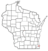
Mount Pleasant, Wisconsin
| Mount Pleasant, Wisconsin | ||
|---|---|---|
| Village | ||
 |
||
|
||
| Motto: A Forward Thinking Community... | ||
 Location of Mount Pleasant, Wisconsin |
||
| Coordinates: 42°43′4″N 87°53′11″W / 42.71778°N 87.88639°WCoordinates: 42°43′4″N 87°53′11″W / 42.71778°N 87.88639°W | ||
| Country | United States | |
| State | Wisconsin | |
| County | Racine | |
| Settled | 1835 | |
| Township | 1842 | |
| Incorporated | September 16, 2003 | |
| Government | ||
| • Type | Board of Trustees | |
| • President | Gerald Garski | |
| Area | ||
| • Total | 35.35 sq mi (91.56 km2) | |
| • Land | 33.73 sq mi (87.36 km2) | |
| • Water | 1.62 sq mi (4.20 km2) | |
| Elevation | 715 ft (218 m) | |
| Population (2010) | ||
| • Total | 26,197 | |
| • Estimate (2012) | 26,185 | |
| • Density | 776.7/sq mi (299.9/km2) | |
| Time zone | CST (UTC-6) | |
| • Summer (DST) | CDT (UTC-5) | |
| Area code(s) | 262 | |
| GNIS feature ID | 2012620 | |
| Website | www.mtpleasantwi.gov/ | |
Mount Pleasant is a village in Racine County, Wisconsin, in the United States. It is located approximately 30 miles (50 km) south of Milwaukee and 60 miles (100 km) north of Chicago. As of the 2010 census, the village population was 26,197, making it the 2nd most populous village in the State of Wisconsin and the 29th most populous municipality in the State of Wisconsin.
The community was established as the Town of Mount Pleasant in 1842 when a small group of residents met to organize the settlement. In 1972, Mount Pleasant adopted its zoning ordinance, which established significant locally controlled development. On September 16, 2003 Mount Pleasant incorporated as a village following a referendum passed by the residents.
According to the United States Census Bureau, the village has a total area of 35.35 square miles (91.56 km2), of which, 33.73 square miles (87.36 km2) of it is land and 1.62 square miles (4.20 km2) is water. Local Area Code is 262.
As of the census of 2010, there were 26,197 people, 11,136 households, and 7,395 families residing in the village. The population density was 776.7 inhabitants per square mile (299.9/km2). There were 11,827 housing units at an average density of 350.6 per square mile (135.4/km2). The racial makeup of the village was 86.0% White, 6.7% African American, 0.2% Native American, 2.1% Asian, 2.9% from other races, and 2.0% from two or more races. Hispanic or Latino of any race were 8.3% of the population.
...
Wikipedia

