Mount Donna Buang
| Mount Donna Buang | |
|---|---|
|
Location in Victoria
|
|
| Highest point | |
| Elevation | 1,250 metres (4,100 ft) AHD |
| Coordinates | 37°42′23″S 145°40′52″E / 37.70639°S 145.68111°ECoordinates: 37°42′23″S 145°40′52″E / 37.70639°S 145.68111°E |
| Geography | |
| Location | Victoria, Australia |
| Parent range | Donna Buang Range, Victorian Alps, Great Dividing Range |
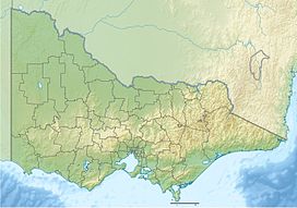
Mount Donna Buang is a mountain in the southern reaches of the Victorian Alps of the Great Dividing Range, located in the Australian state of Victoria. Approximately 80 kilometres (50 mi) from Melbourne with an elevation of 1,250 metres (4,101 ft), Mount Donna Buang is the closest snowfield to Melbourne.
In winter, it usually receives snow suitable for snowplay and tobogganing, and during the non-winter months the area is well visited by bushwalkers and cyclists. The summit of Mount Donna Buang is surrounded by alpine ash trees and sub-alpine snow gums, and at nearby Cement Creek there is a raised walkway through myrtle beech (Nothofagus cunninghamii) and mountain ash (Eucalyptus regnans) trees known as the Mount Donna Buang Skywalk.
Mount Donna Buang is part of the Yarra Ranges National Park (formed in 1995) in which there are a number of species that have become rare or threatened, including the slender tree fern, and the geebung tree. It contains a number of native mammals including the endangered Leadbeater's possum, and is home to 120 species of native birds. Some examples include the pink robin, yellow-tailed black cockatoo and the crimson rosella.
The nearest serviced town to the mountain is Warburton.
The rare and possibly endangered Mount Donna Buang wingless stonefly (Riekoperla darlingtoni) is endemic to the area.
...
Wikipedia

