Motomiya, Fukushima
|
Motomiya 本宮市 |
|||
|---|---|---|---|
| City | |||

Motomiya City Hall
|
|||
|
|||
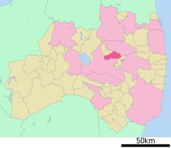
 Location of Motomiya in Fukushima Prefecture |
|||
| Coordinates: 37°30′47.5″N 140°23′37.8″E / 37.513194°N 140.393833°ECoordinates: 37°30′47.5″N 140°23′37.8″E / 37.513194°N 140.393833°E | |||
| Country | Japan | ||
| Region | Tōhoku | ||
| Prefecture | Fukushima Prefecture | ||
| Government | |||
| • - Mayor | Kajū Satō | ||
| Area | |||
| • Total | 87.94 km2 (33.95 sq mi) | ||
| Population (December 1, 2014) | |||
| • Total | 30,505 | ||
| • Density | 347/km2 (900/sq mi) | ||
| Time zone | Japan Standard Time (UTC+9) | ||
| - Tree | Hamilton's Spindle Tree (Euonymus hamiltonianus) | ||
| - Flower | Peony | ||
| - Bird | Japanese bush warbler | ||
| Phone number | 0243-33-1111 | ||
| Address | 212 aza Bansei, Motomiya, Motomiya-shi, Fukushima-ken 969-1192 | ||
| Website | www |
||
Motomiya (本宮市 Motomiya-shi?) is a city situated in the middle of Nakadōri region of Fukushima Prefecture, Japan.
As of December 2014, the city had an estimated population of 30,505 and a population density of 347 persons per km². The total area was 87.94 km². It is the smallest city in Fukushima, both in terms of population and size.
The modern city of Motomiya was established on January 1, 2007, by the merger of the former town of Motomiya absorbing the village of Shirasawa (both from Adachi District). The city became the first new municipality to form under the New Merger Law, in effect since April 2005.
Located conveniently in the middle of Fukushima Prefecture, Motomiya has easy access to national transportation route including the Tohoku Expressway, Japan National Route 4, and Tohoku JR East rail lines via Motomiya Station.
Conveniently located in the center of Fukushima Prefecture, Motomiya possesses a wide range of geographic features from the hills in the east, to the plains in the west, and the Abukuma River.
Running through Motomiya, the Abukuma River divides the city in two. On the former Motomiya Town side, bordered by the Ou (奥羽) Mountain Range (including Mount Adatara) in the west, and the Abukuma River in the east, flat plains run north to south extending into the Kōriyama Basin. The mountains to the north in Otama Village and Kōriyama serve as the sources for several rivers and streams including the Hyakunichi River (百日川), Adatara River (安達太良川), Seto River (瀬戸川), and Gohyaku River (五百川). The Hyakunichi River and Adatara River share the same source but diverge downstream.
...
Wikipedia


