Moréac
|
Moréac Mourieg |
||
|---|---|---|
| Commune | ||

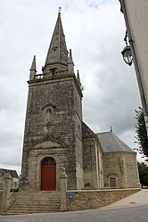
The Church of Saint-Cyr, in Moréac
|
||
|
||
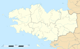
| Coordinates: 47°55′N 2°49′W / 47.92°N 2.82°WCoordinates: 47°55′N 2°49′W / 47.92°N 2.82°W | ||
| Country | France | |
| Region | Brittany | |
| Department | Morbihan | |
| Arrondissement | Pontivy | |
| Canton | Moréac | |
| Government | ||
| • Mayor (2008—2014) | André Allioux | |
| Area1 | 60.30 km2 (23.28 sq mi) | |
| Population (1999)2 | 2,893 | |
| • Density | 48/km2 (120/sq mi) | |
| Time zone | CET (UTC+1) | |
| • Summer (DST) | CEST (UTC+2) | |
| INSEE/Postal code | 56140 /56500 | |
| Elevation | 57–149 m (187–489 ft) | |
|
1 French Land Register data, which excludes lakes, ponds, glaciers > 1 km² (0.386 sq mi or 247 acres) and river estuaries. 2Population without double counting: residents of multiple communes (e.g., students and military personnel) only counted once. |
||
1 French Land Register data, which excludes lakes, ponds, glaciers > 1 km² (0.386 sq mi or 247 acres) and river estuaries.
Moréac (Breton: Mourieg) is a commune in the Morbihan department of Brittany in north-western France.
The Ruisseau de Kerropert forms part of the commune's eastern border, then flows into the Ével, which forms its northern border.
Inhabitants of Moréac are called in French Moréacois.
In 2008, there was 22,12% of the children attended the bilingual schools in primary education.
...
Wikipedia


