Monticello, Indiana
| City of Monticello | |
|---|---|
| City | |

The Monticello Carnegie Library
|
|
| Motto: "Life With A Splash" | |
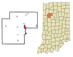
 Location in the state of Indiana |
|
| Coordinates: 40°44′48″N 86°45′55″W / 40.74667°N 86.76528°WCoordinates: 40°44′48″N 86°45′55″W / 40.74667°N 86.76528°W | |
| Country | United States |
| State | Indiana |
| County | White |
| Township | Union |
| Government | |
| • Mayor | Kenneth Houston (D) |
| Area | |
| • Total | 3.69 sq mi (9.56 km2) |
| • Land | 3.47 sq mi (8.99 km2) |
| • Water | 0.22 sq mi (0.57 km2) 5.96% |
| Elevation | 679 ft (207 m) |
| Population (2010) | |
| • Total | 5,378 |
| • Estimate (2012) | 5,342 |
| • Density | 1,549.9/sq mi (598.4/km2) |
| Time zone | EST (UTC-5) |
| • Summer (DST) | EDT (UTC-4) |
| ZIP code | 47960 |
| Area code(s) | 574 |
| FIPS code | 18-50760 |
| GNIS feature ID | 439369 |
| Website | http://www.monticelloin.gov |
Monticello (/mɒntɪˈsɛloʊ/) is a city in Union Township, White County, Indiana, United States. The population was 5,378 at the 2010 census. The city is the county seat of White County.
Monticello is known as a tourist destination in north-central Indiana and is home to the Indiana Beach amusement park, Lake Shafer, and Lake Freeman.
Monticello is located at 40°44′48″N 86°45′55″W / 40.74667°N 86.76528°W (40.746709, -86.765359).
According to the 2010 census, Monticello has a total area of 3.686 square miles (9.55 km2), of which 3.47 square miles (8.99 km2) (or 94.14%) is land and 0.216 square miles (0.56 km2) (or 5.86%) is water.
As of the census of 2010, there were 5,378 people, 2,179 households, and 1,319 families residing in the city. The population density was 1,549.9 inhabitants per square mile (598.4/km2). There were 2,457 housing units at an average density of 708.1 per square mile (273.4/km2). The racial makeup of the city was 90.8% White or European American, 0.4% African American, 0.4% Native American, 0.8% Asian, 5.5% from other races, and 2.1% from two or more races. Hispanic or Latino of any race were 12.5% of the population.
...
Wikipedia
