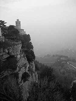
Montefalcone Appennino
| Montefalcone Appennino | ||
|---|---|---|
| Comune | ||
| Comune di Montefalcone Appennino | ||
 |
||
|
||
| Location of Montefalcone Appennino in Italy | ||
| Coordinates: 42°59′N 13°27′E / 42.983°N 13.450°ECoordinates: 42°59′N 13°27′E / 42.983°N 13.450°E | ||
| Country | Italy | |
| Region | Marche | |
| Province / Metropolitan city | Fermo | |
| Government | ||
| • Mayor | Adamo Rossi | |
| Area | ||
| • Total | 16.0 km2 (6.2 sq mi) | |
| Elevation | 757 m (2,484 ft) | |
| Population (31 December 2008) | ||
| • Total | 503 | |
| • Density | 31/km2 (81/sq mi) | |
| Demonym(s) | Montefalconesi | |
| Time zone | CET (UTC+1) | |
| • Summer (DST) | CEST (UTC+2) | |
| Postal code | 63020 | |
| Dialing code | 0734 | |
| Patron saint | St. Michael Archangel | |
| Saint day | 8 May | |
| Website | Official website | |
Montefalcone Appennino is a comune (municipality) in the Province of Fermo in the Italian region Marche, located about 85 kilometres (53 mi) south of Ancona, about 30 kilometres (19 mi) northwest of Ascoli Piceno and about 35 kilometres (22 mi) east of Fermo. It occupies a spur between the rivers Aso and Tenna.
The main sights are the tower of the former castle, the church of St. Peter (14th century) and the church of Santa Maria delle Scalelle (Santa Maria in Capite Scalorum, 14th century).
...
Wikipedia


