Monte Taburno
| Taburnus | |
|---|---|
 |
|
| Highest point | |
| Elevation | 1,393 m (4,570 ft) |
| Coordinates | 41°6′30″N 14°36′30″E / 41.10833°N 14.60833°ECoordinates: 41°6′30″N 14°36′30″E / 41.10833°N 14.60833°E |
| Geography | |
| Location | Province of Benevento, Campania, Italy |
| Parent range | Campanian Appennines |
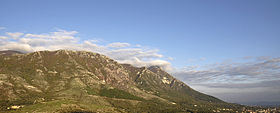
Monte Taburno, or Taburno Camposauro is a group of mountains in the Apennines, to the west of Benevento, central Italy.
The highest peak is the Taburno, at 1,393 m. It is separated from the Matese mountains by the Valle Telesina, while the densely settled Valle Caudina divides Taburno from the Montevergine massif.
Known as mons Taburnus to the Romans, the mountain lies in the territory of Samnium. The Samnites scored a famous victory over the Roman army in the nearby Caudine Forks in 321 BC.
Taburno Camposauro is an isolated calcareous massif in the Campania Apennine Mountain chain. It is situated exactly to the west of Benevento from which it is few kilometres far and in whose district it completely extends. The period in which it was formed is the Mesozoic period. To the north the mount is separated from the Matese mountains by the Telese Valley which is crossed by the Calore river, while to the south it is separated from the Partenio mountains by the Caudin Valley. The highest peaks are the mounts: Taburno (1393 mt a.s.l.), Camposauro (1390 mt a.s.l.),.), Alto Rotondi (1305 mt a.s.l.),.), Sant'Angelo (1189 mt a.s.l.),), Gaudello (1226 mt a.s.l.),) and Pentime (1168 mt a.s.l.), which are placed in a semicircle thus shaping the Vitulano Valley in the center.
The mount is made up of two limestone blocks separated by the Prata Plan. Seen from the city of Benevento the profile of the mountain looks like a laying woman with her feet pointing to the Caudin Valley and her head (Pentime) towards the Telese Valley; for this reason it is commonly referred to as the “Samnium’s Sleeping Beauty”. In spite of some relatively scarcity of rivers the ecosystems of the area are very rich in biodiversity. The animal species which characterizes the Taburno Mount is the buzzard. There are also the woodpecker, the “Imperial crow”, the robin, some birds similar to sparrows and small mammals.
Towns lying at the base of the mountain include Bucciano, Montesarchio, and Cautano.
In the lower places the vegetation is made up of roverella oaks, above 700 meters’ height it is constituted by maples, hornbeams and ash trees, above 900 meters the beech is the most common tree while, between 1000 and 1100 meters we find the holm oak. The Taburno Mount has been protected since the “Taburno-Camposauro Natural Park” was constituted (14 September 1994) by the Taburno “Comunità Montana”. The Taburno Mount us also protected by the Taburno Landscape Plan, which became operative in 1996. From the top of Taburno you can enjoy the wide panorama of the Caudin Valley, rich in human establishments and closed up, on the opposed side by the Partenio Mount. To the west, where the valley becomes narrower, you can notice a white spot on a mountain side: it is the quarry of Tairano Mount where in 321 a.C. the battle between the Romans and the Samnites (the so-called Battle of the Caudine Forks) took place. Beyond the Partenio, during some very clear days, it is possible to see the Vesuvio volcano and the Lattari Mountains.
...
Wikipedia
