Monte Gordo, Cape Verde
| Monte Gordo | |
|---|---|

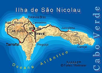
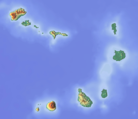
Location of Monte Gordo in the island of São Nicolau displayed on the left
|
|
| Highest point | |
| Elevation | 1,312 m (4,304 ft) |
| Prominence | 1,312 m (4,304 ft) |
| Listing | List of mountains in Cape Verde |
| Coordinates | 16°37′15″N 24°21′15″W / 16.62083°N 24.35417°WCoordinates: 16°37′15″N 24°21′15″W / 16.62083°N 24.35417°W |
| Geography | |
|
western São Nicolau
|
|
| Geology | |
| Mountain type | Stratovolcano |
Monte Gordo is a mountain on the island of São Nicolau, Cape Verde. At 1,312 m elevation, it is the island's highest point. It is situated in the western part of the island, 6 km west of the island capital Ribeira Brava. The mountain is of volcanic origin. The boundary of the municipalities Tarrafal de São Nicolau and Ribeira Brava runs over the mountain. It is part of a natural park (name: Monte Gordo Natural Park (Portuguese: Parque Natural de Monte Gordo)), which has been created to protect the typical humid mountain ecosystem, it was established on February 24, 2003 and is category V by the IUCN, it also forms a part of the Central mountain range of Ilha de São Nicolau Important Bird Area.
Villages inside the mountain range includes Cachaço, Cabeçalinho, Covada and Fragata. Villages on the foot of the mountain include Hortelão, Palhal and Ribeira dos Calhaus, much of the villages are partly covered by the park area, Ribeira dos Calhaus are completely covered by the natural park.
Monte Gordo is connected with the EN1-SN-01 1.4 kilometers with the EN3-SN05 (or Route 3, Insular Route 5).
Much of the area are forested especially with pine trees (laurisilva are non-existent in Cape Verde). Some of the higher parts of the site are forested, especially around Monte Gordo where relatively high rainfall and frequent misty conditions cause the trees to be thickly covered with lichens.
...
Wikipedia

