Montague, Ontario
| Montague | |
|---|---|
| Township (lower-tier) | |
| Township of Montague | |

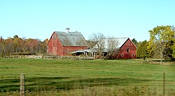
Farm near Numogate
|
|
 Montague within Lanark County |
|
| Montague within southern Ontario | |
| Coordinates: 44°59′N 75°59′W / 44.98°N 75.98°WCoordinates: 44°59′N 75°59′W / 44.98°N 75.98°W | |
| Country |
|
| Province |
|
| County | Lanark |
| Government | |
| • Type | Township |
| • Reeve | Bill Dobson |
| • Governing Body | Montague Township Council |
| • MP | Scott Reid (CPC) |
| • MPP | Randy Hillier (OPC) |
| Area | |
| • Total | 279.74 km2 (108.01 sq mi) |
| Population (2011) | |
| • Total | 3,483 |
| • Density | 12.5/km2 (32/sq mi) |
| Time zone | EST (UTC-5) |
| • Summer (DST) | EDT (UTC-4) |
| Area code(s) | 613 |
| Website | www |
Montague is a township in eastern Ontario, Canada, in Lanark County on the Rideau River.
The township comprises the communities of Andrewsville, Atironto, Kilmarnock, Nolans Corners, Numogate, Poolers Corners, Rosedale and Welsh.
...
Wikipedia

