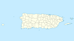
Mona, Puerto Rico
| Nickname: Amona | |
|---|---|

Satellite Image
|
|
| Geography | |
| Coordinates | 18°5′12″N 67°53′22″W / 18.08667°N 67.88944°WCoordinates: 18°5′12″N 67°53′22″W / 18.08667°N 67.88944°W |
| Area | 57 km2 (22 sq mi) |
| Length | 11 km (6.8 mi) |
| Width | 7 km (4.3 mi) |
| Administration | |
|
Puerto Rico
|
|
| Municipality | Mayagüez |
| Barrio/Ward | Isla de Mona e Islote Monito |
| Additional information | |
| Designated | December 17, 1993 |
| Reference no. | 93001398 |
| Designated | 1975 |
Mona (Spanish: Isla de la Mona) is the third-largest island of the Puerto Rican archipelago, after the main island of Puerto Rico and Vieques. It is the largest of three islands located in the Mona Passage, a strait between the Dominican Republic and Puerto Rico, the others being Monito Island and Desecheo Island. It measures about 11 km by 7 km (7 miles by 4 miles), and lies 66 km (41 mi) west of Puerto Rico, of which it is administratively a part. The original name given to the island by the Taíno Indians is Amona, which means "what is in the middle", referring to the journey between the islands of Puerto Rico and Hispaniola. It is one of two islands that make up the Isla de Mona e Islote Monito Barrio of Mayagüez, Puerto Rico.
The island is managed as the Mona Island Nature Reserve (Spanish: Reserva Natural Isla de Mona). There are no native inhabitants; only rangers and biologists from Puerto Rico's Department of Natural and Environmental Resources reside on the island, to manage visitors and take part in research projects.
Mona Island is believed to have been originally settled by Arawak Indians who arrived from Quisqueya (Hispaniola: present day Haiti and the Dominican Republic). An archeological excavation during the 1980s discovered many Pre-Columbian objects on the island that helped support historians' theories of the island's first inhabitants. Stone tools found in a rock shelter have been dated to around 3000 BC. Much later the island was settled by the Taínos and remained so until the arrival of the Spanish in the 15th century.
...
Wikipedia

