Moloka'i
| Nickname: The Friendly Isle | |
|---|---|

Satellite image of Molokaʻi.
|
|
| Geography | |
| Location | 21°08′N 157°02′W / 21.133°N 157.033°W |
| Area | 260 sq mi (670 km2) |
| Area rank | 5th largest Hawaiian Island |
| Highest elevation | 4,961 ft (1,512.1 m) |
| Highest point | Kamakou |
| Administration | |
| Symbols | |
| Flower | Kukui |
| Color | ʻŌmaʻomaʻo (green) |
| Demographics | |
| Population | 7,345 (2010) |
| Pop. density | 28 /sq mi (10.8 /km2) |
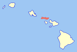
Molokaʻi or Molokai (/ˈmɒləkaɪ/; Hawaiian: [ˈmoloˈkɐʔi]), often called the "Friendly Island", is an island in the Hawaiian archipelago. It is 38 by 10 miles (61 by 16 km) in size at its extreme length and width with a usable land area of 260 square miles (673.40 km2), making it the fifth-largest of the main Hawaiian Islands and the 27th largest island in the United States. It lies east of Oʻahu across the 25-mile (40 km) wide Kaiwi Channel and north of Lānaʻi, separated from it by the Kalohi Channel.
The island has been known both for developments by Molokai Ranch on much of the island, for pineapple production, cattle ranching and tourism. Residents or visitors to the west end of Molokaʻi can see the lights of Honolulu on O'ahu at night; they can view nearby Lānaʻi and Maui from anywhere along the south shore of the island. In Kalawao County, on the Kalaupapa Peninsula on the north coast, settlements were established in 1866 for quarantined treatment of persons with leprosy; these operated until 1969. The Kalaupapa National Historical Park now preserves this entire county and area.
...
Wikipedia

