Mohall, North Dakota
| Mohall, North Dakota | |
|---|---|
| City | |
| Motto: Beautiful Town, Beautiful People. | |
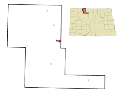
 Location of Mohall, North Dakota |
|
| Coordinates: 48°45′54″N 101°30′40″W / 48.76500°N 101.51111°WCoordinates: 48°45′54″N 101°30′40″W / 48.76500°N 101.51111°W | |
| Country | United States |
| State | North Dakota |
| County | Renville |
| Area | |
| • Total | 1.08 sq mi (2.80 km2) |
| • Land | 1.08 sq mi (2.80 km2) |
| • Water | 0 sq mi (0 km2) |
| Elevation | 1,640 ft (500 m) |
| Population (2010) | |
| • Total | 783 |
| • Estimate (2015) | 808 |
| • Density | 725.0/sq mi (279.9/km2) |
| Time zone | Central (CST) (UTC-6) |
| • Summer (DST) | CDT (UTC-5) |
| ZIP code | 58761 |
| Area code(s) | 701 |
| FIPS code | 38-53780 |
| GNIS feature ID | 1030268 |
| Website | http://www.mohallndak.com/ |
Mohall is a city in Renville County, North Dakota, United States. It is the county seat of Renville County. The population was 783 at the 2010 census. Mohall is part of the Minot Micropolitan Statistical Area.
Mohall was founded in 1901 by M.O. Hall, a businessman from Duluth, Minnesota. The city was originally named Hall but this conflicted with another community in North Dakota with the same name, so it was changed to Mohall in 1902. In 1910, Mohall was established as the county seat for Renville County.
Mohall is located at 48°45′54″N 101°30′40″W / 48.76500°N 101.51111°W (48.765010, -101.511043). According to the United States Census Bureau, the city has a total area of 1.08 square miles (2.80 km2), all of it land.
The Mohall Municipal Airport is located at 48°46′06.2″N 101°32′13.2″W / 48.768389°N 101.537000°W (48.7683833, -101.5369953), about a mile west of Mohall proper. Beginning operations in December 1944, the airport is owned by the city.
...
Wikipedia
