Milecastle 26
| Milecastle 26 | |
|---|---|

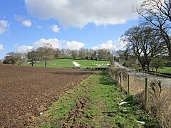
Looking towards the site of Milecastle 26 on Hadrian's Wall Path
|
|
|
|
|
| OS grid reference | NY93086955 |
| Coordinates | 55°01′14″N 2°06′35″W / 55.020461°N 2.109670°WCoordinates: 55°01′14″N 2°06′35″W / 55.020461°N 2.109670°W |
|
|
Milecastle 26 (Planetrees) was a milecastle of the Roman Hadrian's Wall. Its position is slightly to the south of, but mostly covered by the B6318 Military Road., and it is located around 700 metres (0.43 mi) east of the B6318 Military Road's junction with the A6079. No visible traces exist currently. The dimensions are the same as Milecastles 23, 24, and 25.
Measuring 15.24 metres (50.0 ft) across, Milecastle 26 was a long-axis milecastle with unknown gateway type. Such milecastles were thought to have been constructed by the Legio VI Victrix who were based in Eboracum (York).
A causeway over the wall ditch (not necessarily primary) may have existed at the location of the milecastle.
The curtain wall is broad at this point, though changes to narrow gauge between here and Turret 26A, at an extant section of the curtain wall known as Planetrees. Also, in 1956, two iron wedges for splitting stones (260 millimetres (10 in) long) were discovered in the rubble and mortar core behind the north facing stones of the wall in a trench cut beside the farm.
Each milecastle on Hadrian's Wall had two associated turret structures. These turrets were positioned approximately one-third and two-thirds of a Roman mile to the west of the Milecastle, and would probably have been manned by part of the milecastle's garrison. The turrets associated with Milecastle 26 are known as Turret 26A and Turret 26B.
Turret 26A (High Brunton) was located adjacent to the B6318 Military Road, opposite High Brunton House, by Miss T Hepple (in 1930). Subsequent examination in 1959 revealed a turret with an original floor of clay and mortar, which had been overlain in part by stone. It had twice been resurfaced with sand, and twice with flags, a new hearth being established on each occasion. A small area, delineaeted by kerbs, existed throughout the life of the turret, though its usage remains unknown. Finds indicating evidence of bronze casting where unearthed, including a crucible and a whetstone. Fragments of pottery including those of two flagons and one amphora where found. Unusually, some of these fragments were identified to have been manufactured by Legio VI Victrix near York around 120AD, suggesting they may have built the turret. No finds at the site indicated occupation later than the second century.Brunton Bank Quarry, a geological Site of Special Scientific Interest lies 0.2 miles (0.32 km) north of Turret 26A.
...
Wikipedia

