Middletown, Indiana
| Middletown, Indiana | |
|---|---|
| Town | |
 |
|
 Location of Middletown in the state of Indiana |
|
| Coordinates: 40°3′26″N 85°32′28″W / 40.05722°N 85.54111°WCoordinates: 40°3′26″N 85°32′28″W / 40.05722°N 85.54111°W | |
| Country | United States |
| State | Indiana |
| County | Henry |
| Township | Fall Creek |
| Area | |
| • Total | 1.16 sq mi (3.00 km2) |
| • Land | 1.16 sq mi (3.00 km2) |
| • Water | 0 sq mi (0 km2) |
| Elevation | 978 ft (298 m) |
| Population (2010) | |
| • Total | 2,322 |
| • Estimate (2012) | 2,282 |
| • Density | 2,001.7/sq mi (772.9/km2) |
| Time zone | Eastern (EST) (UTC-5) |
| • Summer (DST) | EDT (UTC-4) |
| ZIP code | 47356 |
| Area code(s) | 765 |
| FIPS code | 18-49014 |
| GNIS feature ID | 0439117 |
| Website | http://www.middletownin.com/ |
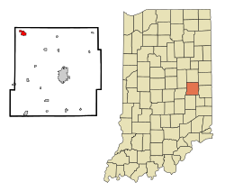
Middletown is a town in northwest Henry County, Indiana, United States. The population was 2,322 at the 2010 census.
Middletown was platted in 1829. The town's name is locational, for it lies halfway between New Castle and Anderson. A post office was established at Middletown in 1830. Middletown was incorporated as a town in 1840.
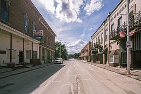
The John W. Hedrick House and Middletown Commercial Historic District are listed on the National Register of Historic Places.
Middletown is located at 40°3′26″N 85°32′28″W / 40.05722°N 85.54111°W (40.057094, -85.541098).
According to the 2010 census, Middletown has a total area of 1.16 square miles (3.00 km2), all land.
As of the census of 2010, there were 2,322 people, 894 households, and 594 families residing in the town. The population density was 2,001.7 inhabitants per square mile (772.9/km2). There were 998 housing units at an average density of 860.3 per square mile (332.2/km2). The racial makeup of the town was 97.6% White, 0.3% African American, 0.1% Native American, 0.5% Asian, 0.2% from other races, and 1.3% from two or more races. Hispanic or Latino of any race were 0.8% of the population.
...
Wikipedia
