Michelsberg (Eifel)
| Michelsberg | |
|---|---|

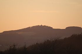
View from the Hochthürmerberg looking west-southwest to the Michelsberg with the tower of the St. Michael's Chapel at dusk
|
|
| Highest point | |
| Elevation | 586.1 m above sea level (NHN) (1,923 ft) |
| Coordinates | 50°30′45″N 6°49′27″E / 50.512611°N 6.824083°ECoordinates: 50°30′45″N 6°49′27″E / 50.512611°N 6.824083°E |
| Geography | |
|
|
|
| Parent range | Ahr Hills, Eifel |
The Michelsberg, at 586.1 m above sea level (NHN), is the highest point in the borough of Bad Münstereifel in the county of Euskirchen in the German state of North Rhine-Westphalia. The hill, which rises near the village of Mahlberg belongs to that part of the Eifel mountains known as the Ahr Hills (Ahreifel), and is the second highest point in the range.
The Michelsberg rises on the northwestern edge of the Ahr Hills in the High Fens-Eifel Nature Park. Its summit lies 1.2 km east-northeast of the centre of Mahlberg, which extends to the southwestern flank of the hill, and 1.5 km west-northwest of Reckerscheid. Some distance away to the south is the village of Esch with its hamlet of Wasserscheide. All these villages belong to the borough of Bad Münstereifel.
The Michelsberg lies within the natural regional major unit group of East Eifel (Osteifel, no. 27) on the boundary of its southern subdivision, the Northern Ahr Hill Country (Nördliches Ahrbergland, 272.1) which belongs to the Ahr Eifel (Ahreifel, 272), with its northern subdivision, the Münstereifel Forest (Münstereifeler Wald, 274.1), which belongs to the major unit of Münstereifel Forest and Nordeastern Foot of the Eifel (Münstereifeler Wald und Nordöstlicher Eifelfuß, 274). The western slopes of the hill drop into the subunit of the Münstereifel Valley (Münstereifeler Tal, 274.0).
According to a trig point marked on the German base map, the Michelsberg is 586.1 m. Its summit, whose height is also given as 588 m, is located on the middle of three tops or kuppen. From the main top, the countryside runs via a saddle at 564.6 m to the Michelsberg North Top, also called the Hohberg (574.5 m). To the southwest is another top, 573.5 m. In topographic maps of the Bundesamt für Naturschutz the summit region is also given a height of 566.1 m.
...
Wikipedia

