Miangas
| Native name: Pulau Miangas | |
|---|---|
|
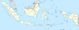
Location of Miangas in Indonesia
|
|
| Geography | |
| Coordinates | 5°34′02″N 126°34′54″E / 5.5672°N 126.5817°ECoordinates: 5°34′02″N 126°34′54″E / 5.5672°N 126.5817°E |
| Archipelago | Talaud Islands |
| Administration | |
|
Indonesia
|
|
Miangas or Palmas is North Sulawesi's northernmost island, and one of 92 officially listed outlying islands of Indonesia.
Miangas means "exposed to piracy", because pirates from Mindanao used to visit the island. In the 16th century, the island was named in Spanish Isla de las Palmas, and in Portuguese Ilha de Palmeiras. In the Sasahara language, the island is called Tinonda or Poilaten, which mean "people who live separated from the main archipelago" and "our island" respectively.
According to local tradition, there were a number of kingdoms in the area. Sangir, Talaud and Sitaro belonged to two kingdoms, Tabukan and Kalongan. To justify their sovereignty over Miangas, the Dutch argued that the island had been under the domination of the princes of Sangir.
In October 1526, Garcia Jofre de Loaísa, Spanish sailor and researcher, was the first European to visit the island.
The island was used as a defense site by Talaud people when under attack from the Sulu Sultanate.
The island was affected by the outbreak of cholera in 1885, causing hundreds of the inhabitants to move to Karakelang Island.
In 1895, E. J. Jellesma, Oud-resident of Manado, visited Miangas to praise the residents and kapiten laut for rejecting the Spanish flag. Jellesma gave them a medal and a Dutch flag. With Jellesma was Pastor Kroll, who baptized 254 residents as Protestants. After Jellesma's visit, a Tahuna assistant resident and Pastor Pannings visited the island in April and October 1909.
According to the Treaty of Paris, the Philippines area was all areas within a large geographic box. Miangas lay inside the southern boundary of the box. On 21 January 1906, General Leonard Wood, Governor General of Moro, officially visited the island for the first time. He found the Dutch flag already flew there and that the island was claimed as part of the Dutch East Indies. When Wood returned to Zamboanga, he reported it to the United States Military Secretary, on 26 January 1906. The United States government referred the matter to the Netherlands through their embassy in The Hague on 31 March 1906. On 17 October 1906 the Netherlands Foreign Ministry responded with reasons why the island was included in the Dutch East Indies. On 23 January 1925 the Netherlands and the United States brought the case to the Permanent Court of Arbitration, under a sole arbitrator Max Huber of Switzerland. On 4 April 1928 Huber decided that the island "forms in its entirety a part of Netherlands territory".
...
Wikipedia

