Merrillville, IN
| Town of Merrillville, Indiana | ||
|---|---|---|
| Town | ||

Merrillville Skyline
|
||
|
||
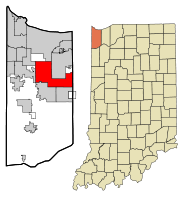
 Location in the state of Indiana |
||
| Coordinates: 41°29′8″N 87°20′7″W / 41.48556°N 87.33528°WCoordinates: 41°29′8″N 87°20′7″W / 41.48556°N 87.33528°W | ||
| Country | United States | |
| State | Indiana | |
| County | Lake | |
| Township | Ross | |
| Government | ||
| • Type | Town | |
| Area | ||
| • Total | 33.26 sq mi (86.14 km2) | |
| • Land | 33.22 sq mi (86.04 km2) | |
| • Water | 0.04 sq mi (0.10 km2) | |
| Elevation | 656 ft (200 m) | |
| Population (2010) | ||
| • Total | 35,246 | |
| • Estimate (2012) | 35,631 | |
| • Density | 1,061.0/sq mi (409.7/km2) | |
| Time zone | CST (UTC-6) | |
| • Summer (DST) | CDT (UTC-5) | |
| ZIP codes | 46410, 46411, 46342(Partial) | |
| Area code(s) | 219 | |
| FIPS code | 18-48528 | |
| GNIS feature ID | 0439028 | |
| Website | www.merrillville.in.gov | |
| Merrillville | ||||||||||||||||||||||||||||||||||||||||||||||||||||||||||||
|---|---|---|---|---|---|---|---|---|---|---|---|---|---|---|---|---|---|---|---|---|---|---|---|---|---|---|---|---|---|---|---|---|---|---|---|---|---|---|---|---|---|---|---|---|---|---|---|---|---|---|---|---|---|---|---|---|---|---|---|---|
| Climate chart () | ||||||||||||||||||||||||||||||||||||||||||||||||||||||||||||
|
||||||||||||||||||||||||||||||||||||||||||||||||||||||||||||
|
||||||||||||||||||||||||||||||||||||||||||||||||||||||||||||
| J | F | M | A | M | J | J | A | S | O | N | D |
|
1.7
32
15
|
1.4
36
18
|
2.5
48
28
|
3.7
60
38
|
3.7
72
47
|
3.9
82
57
|
3.7
85
62
|
3.7
84
61
|
4.1
77
54
|
2.8
66
44
|
3.3
51
34
|
2.6
36
21
|
| Average max. and min. temperatures in °F | |||||||||||
| Precipitation totals in inches | |||||||||||
| Source: Countrystudies.us | |||||||||||
| Metric conversion | |||||||||||
|---|---|---|---|---|---|---|---|---|---|---|---|
| J | F | M | A | M | J | J | A | S | O | N | D |
|
43
0
−9
|
36
2
−8
|
64
9
−2
|
94
16
3
|
94
22
8
|
99
28
14
|
94
29
17
|
94
29
16
|
Wikipedia
...
| |||

