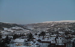
Meråker
| Meråker kommune | |||
|---|---|---|---|
| Municipality | |||

View of Meråker
|
|||
|
|||
 Meråker within Nord-Trøndelag |
|||
| Coordinates: 63°26′17″N 11°50′58″E / 63.43806°N 11.84944°ECoordinates: 63°26′17″N 11°50′58″E / 63.43806°N 11.84944°E | |||
| Country | Norway | ||
| County | Nord-Trøndelag | ||
| District | Stjørdalen | ||
| Administrative centre | Midtbygda | ||
| Government | |||
| • Mayor (1995) | Bård Langsåvold (Ap) | ||
| Area | |||
| • Total | 1,273.41 km2 (491.67 sq mi) | ||
| • Land | 1,188.27 km2 (458.79 sq mi) | ||
| • Water | 85.14 km2 (32.87 sq mi) | ||
| Area rank | 74 in Norway | ||
| Population (2011) | |||
| • Total | 2,503 | ||
| • Rank | 299 in Norway | ||
| • Density | 2.1/km2 (5/sq mi) | ||
| • Change (10 years) | -3.5 % | ||
| Demonym(s) | Meråkerbygg | ||
| Time zone | CET (UTC+1) | ||
| • Summer (DST) | CEST (UTC+2) | ||
| ISO 3166 code | NO-1711 | ||
| Official language form | Bokmål | ||
| Website | www |
||
|
|
|||
Meråker is a municipality in Nord-Trøndelag county, Norway. It is part of the Stjørdalen region. The administrative centre of the municipality is the village of Midtbygda which is about 20 kilometres (12 mi) west of Storlien in Sweden and 46 kilometres (29 mi) east of Stjørdalshalsen in Stjørdal. Other villages in Meråker include Gudåa, Kopperå, and Stordalen.
The municipality markets itself as a recreational area. The main areas of employment are in industry and agriculture. The municipality is noted for its characteristic dialect.
The municipality of Meråker was established on 1 January 1874 when the old municipality of Øvre Stjørdal was divided into two: Hegra and Meråker. Meråker had an initial population of 1,861. The municipality has not changed since then.
The municipality (originally the parish) is named after the old Meråker farm (spelled "Mørakre" around 1430), since the first church was built there. The meaning of the first element is uncertain (maybe merr which means "mare" or mýrr which means "bog" or "marsh") and the last element is akr which means "field" or "acre".
...
Wikipedia


