Mengerskirchen
| Mengerskirchen | ||
|---|---|---|
|
||
| Coordinates: 50°33′50″N 08°09′21″E / 50.56389°N 8.15583°ECoordinates: 50°33′50″N 08°09′21″E / 50.56389°N 8.15583°E | ||
| Country | Germany | |
| State | Hesse | |
| Admin. region | Gießen | |
| District | Limburg-Weilburg | |
| Government | ||
| • Mayor | Thomas Scholz (CDU) | |
| Area | ||
| • Total | 30.82 km2 (11.90 sq mi) | |
| Elevation | 430 m (1,410 ft) | |
| Population (2015-12-31) | ||
| • Total | 5,787 | |
| • Density | 190/km2 (490/sq mi) | |
| Time zone | CET/CEST (UTC+1/+2) | |
| Postal codes | 35794 | |
| Dialling codes | 06476 | |
| Vehicle registration | LM | |
| Website | www.mengerskirchen.de | |
Mengerskirchen is a community in Limburg-Weilburg district in Hesse, Germany.
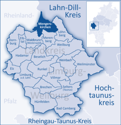
Mengerskirchen borders in the north on the community of Greifenstein (Lahn-Dill-Kreis), in the east on the community of Löhnberg, in the south on the communities of Merenberg and Waldbrunn (all three in Limburg-Weilburg), and in the west on the communities of Neunkirchen, Elsoff and Oberrod (all three in the Westerwaldkreis in Rhineland-Palatinate).
Mengerskirchen’s Ortsteile are, Dillhausen, Mengerskirchen, Probbach, Waldernbach and Winkels.
The community administration’s seat is the market centre of Mengerskirchen. Each of the constituent communities is represented on a municipal advisory board (Ortsbeirat) by a community head (Ortsvorsteher).
Around the Knoten, the highest elevation in the community of Mengerskirchen, those who are interested can give themselves over to cross-country skiing during the winter months. In summer, the two man-made lakes, Seeweiher and Waldsee, offer the opportunity to bathe.
Mengerskirchen had its first documentary mention in a document from the St. Lubentius Monastery in Dietkirchen an der Lahn in 1279. The outlying community of Winkels had already been mentioned in 1243, Waldernbach in 1296, Probbach in 1299 and Dillhausen in 1307. Mengerskirchen was described in 1307 as an “oppidum”. Town rights are documentarily confirmed only on 18 February 1321. In 1481 came market rights, too.
...
Wikipedia


