Menard, Texas
| Menard, Texas | |
|---|---|
| City | |

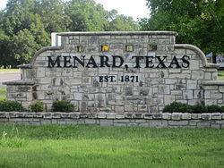
Menard welcome sign
|
|
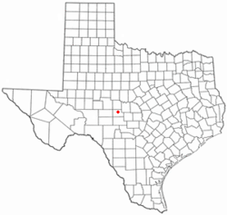
 Location of Menard, Texas |
|
 |
|
| Coordinates: 30°55′10″N 99°47′4″W / 30.91944°N 99.78444°WCoordinates: 30°55′10″N 99°47′4″W / 30.91944°N 99.78444°W | |
| Country | United States |
| State | Texas |
| County | Menard |
| Area | |
| • Total | 2.1 sq mi (5.3 km2) |
| • Land | 2.1 sq mi (5.3 km2) |
| • Water | 0.0 sq mi (0.0 km2) |
| Elevation | 1,883 ft (574 m) |
| Population (2000) | |
| • Total | 1,653 |
| • Density | 803.5/sq mi (310.2/km2) |
| Time zone | Central (CST) (UTC-6) |
| • Summer (DST) | CDT (UTC-5) |
| ZIP code | 76859 |
| Area code(s) | 325 |
| FIPS code | 48-47628 |
| GNIS feature ID | 1362610 |
Menard is a city in and the county seat of Menard County, Texas, United States. The population was 1,653 at the 2000 census.
Menard is located at 30°55′10″N 99°47′4″W / 30.91944°N 99.78444°W (30.919519, -99.784446). It is situated along the banks of the San Saba River at the junction of U.S. Highways 83 and 190, approximately 140 miles northwest of Austin and San Antonio in central Menard County.
According to the United States Census Bureau, the city has a total area of 2.1 square miles (5.4 km2), all of it land.
The first settlement at the site of what is now Menard was the Spanish Mission San Sabá and the Presidio of San Luís de Amarillas, both established in April 1757. The presidio was later replaced by the Presidio of San Sabá in 1761. Both were intended to protect New Spain's northern frontier from marauding Comanches. Due to the presidio's isolation, it suffered repeated attacks, and was finally abandoned in 1770. Stones from the old presidio walls were used by later settlers to build homes and fences. The ruins of the old presidio were reconstructed in 1936.
The community was first known as Menardville when the site was laid out in 1858, after the formation of Menard County. Nearby Fort McKavett was deactivated in 1859, leaving the settlers with little protection from frequent Indian raids. The fort reopened after the Civil War. By 1867, Menardville had a store, a blacksmith shop, and a saloon. The community served as a trading post and overnight stop on north and west cattle trails. A county government was organized in 1871 and a two-story courthouse was built one year later. Menardville had approximately 150 residents by the mid-1880s. The San Saba River flooded in 1899, causing considerable damage to the community.
...
Wikipedia
