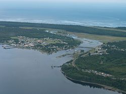
Masset
| Masset | |
|---|---|
| Village | |
| Village of Masset | |
 |
|
| Location of Masset in British Columbia | |
| Coordinates: 54°00′36″N 132°08′17″W / 54.01000°N 132.13806°WCoordinates: 54°00′36″N 132°08′17″W / 54.01000°N 132.13806°W | |
| Country |
|
| Province |
|
| Region | Haida Gwaii |
| Regional district | Skeena-Queen Charlotte |
| Incorporated | 1961 |
| Government | |
| • Governing body | Masset Village Council |
| • Mayor | Andrew Merilees |
| Area | |
| • Total | 19.45 km2 (7.51 sq mi) |
| Elevation | 10 m (30 ft) |
| Population (2016) | |
| • Total | 793 |
| • Density | 41/km2 (110/sq mi) |
| Time zone | PST (UTC−8) |
| Highways | 16 |
| Waterways | Dixon Entrance |
Masset /ˈmæsᵻt/, formerly Massett, is a village in Haida Gwaii (formerly the Queen Charlotte Islands) in British Columbia, Canada. It is located on the northern coast of Graham Island, the largest island in the archipelago, and is approximately 50 km (31 mi) west of mainland British Columbia. It is the western terminus of the Yellowhead Highway and is served by Masset Airport, with flights to Vancouver and Prince Rupert. During the Maritime Fur Trade of the early 19th century, Masset was a key trading site. It was incorporated as a village municipality on May 11, 1961.
The name Masset was a gift from the captain of a Spanish vessel that was repaired with the assistance of the Haida citizens of Atewaas, Kayung and Jaaguhl. These three villages accepted the gift and adopted the name Masset to commemorate what might be the first ever contact between Europeans and the Haida.
During the early years of Canadian colonization the name Masset and the post office were adopted by the former Reverend Charles Harrison as part of his scheme to sell land.
The name Masset is currently in use by the Village of Masset, a municipality under Canada legislation and the Village of Old Massett, the original recipient of the name and a village under the Constitution of the Haida Nation.
According to John T. Walbran, Masset came from the Haida word Masst, or large island. Captain Douglas, on his second visit from Nootka Sound aboard the Iphigenia on June 19, 1789, named the bay leading to the inlet McIntyre's Bay. This name was used on the charts of Dixon and Meares. The American traders called the inlet, Hancock's River as shown in Ingraham's chart of 1792 after the American brig Hancock. In 1853 H.N. Knox of the Royal Navy, mate on HMS Virago, did a sketch survey of the harbour when the name Masset was adopted by the British. A survey was made in 1907 by Captain Learmouth on HMS Egeria.
...
Wikipedia

