Maseru District
| Maseru | |
|---|---|
| District | |

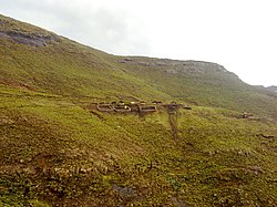
Baboons Pass, Maseru District
|
|
 Map of Lesotho with the district highlighted |
|
| Country |
|
| Area | |
| • Land | 4,279 km2 (1,652 sq mi) |
| Population (2006) | |
| • Total | 429,823 |
| • Density | 100/km2 (300/sq mi) |
| Time zone | CAT (UTC+2) |
Maseru is a district of Lesotho. Maseru is also the name of the district's capital, and is the only city in the district and also the capital of the country. It is the largest urban area in the country, and therefore the only city. The city of Maseru is located on Lesotho's western border with the Free State Province of South Africa, the frontier being the Caledon River. Maseru borders on Berea District in north, Thaba-Tseka District in the east, Mohale's Hoek District in south, and Mafeteng District in southwest.
As of 2006, the district had a population of 431,998 which was 23.02 per cent of the total population of the country. The total area of the district was 4,279 which was 14.10 per cent of the total area of the country. The density of population in the district was 101.00 per sq. km. As of 2008, there were 52 economically active people in the district. There were totally 294,062 employed people out of a total of 585,770 people in the district above 15 years of age.
As of 2006, the district had a population of 431,998, 23.02 per cent of the population of the country. The area of the district was 4,279, 14.10 per cent of the country. The population density was 101.00 persons per square kilometre, compared to the 62 for the country. There were eighteen constituencies and twenty-three community counciles in the district. As of 2006, 1318 people tested HIV positive, 25.50 per cent of the HIV-positive persons in the country. 522 of these (18.10%) were men; 796 (29.90%) were women.
As of 2008, there were 52 economically active people in the district. There were totally 294,062 employed people out of a total of 585,770 people in the district above 15 years of age. The employed population in the age group of 6-14 years was 2,454 out of a total of 157,714 people in the district in the age group. The labour force participation stood at 197.80. The number of people involved in subsistence agriculture is 1,380 and the number of people in other sectors was 1,074. The number of unemployed people in the district was 90,050 and the unemployment rate was 070. The total are planted in 2009 was 20,998 which formed 5.20 per cent of the total area planted in the country. The total production was 10,773 tonnes, which was 7.15 per cent of the totals in the country. The major crop was maize, while wheat, sorghum, beans and peas were the other crops planted. The total production of maize was 8,891 tonnes, beans was 120 tonnes, sorghum was 066 tonnes, peas was 1,066 tonnes and wheat was 630 tonnes as of 2008. As of 2007, there were a total of 391 km (243 mi) of paved roads in the district, with 281 km (175 mi) paved roads and 110 km (68 mi) of unpaved roads.
...
Wikipedia
