Mary Valley
| Mary (Moocooboola) | |
| Wide Bay | |
| River | |
|
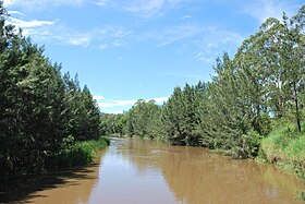
The upper Mary River at Conondale
|
|
| Name origin: Lady Mary Lennox, wife of Charles Augustus FitzRoy | |
| Country | Australia |
|---|---|
| State | Queensland |
| Regions | South East Queensland, Wide Bay–Burnett |
| Tributaries | |
| - left | Yabba Creek, Kandanga Creek, Widgee Creek, Wide Bay Creek, Munna Creek, Susan River |
| - right | Obi Obi Creek, Tinana Creek |
| Source | Conondale Range |
| - location | Conondale, South East Queensland |
| - elevation | 209 m (686 ft) |
| - coordinates | 26°47′39″S 152°44′41″E / 26.79417°S 152.74472°E |
| Mouth | Great Sandy Strait |
| - location | River Heads, Wide Bay–Burnett |
| - elevation | 0 m (0 ft) |
| - coordinates | 26°35′06″S 152°44′01″E / 26.58500°S 152.73361°ECoordinates: 26°35′06″S 152°44′01″E / 26.58500°S 152.73361°E |
| Length | 291 km (181 mi) |
| Basin | 9,595 km2 (3,705 sq mi) |
| Reservoir | Lake Borumba |
|
Location of Mary River mouth in Queensland
|
|
The Mary River (Kabi: Moocooboola) is a major river system located in the South East and Wide Bay–Burnett regions of Queensland, Australia.
The river rises at Booroobin in the Sunshine Coast hinterland, west of Landsborough. From its source, the Mary River flows north through the towns of Kenilworth, Gympie, Tiaro and Maryborough before emptying into the Great Sandy Strait, a passage of water between the mainland and Fraser Island, near the town of River Heads, 17 km (11 mi) south of Hervey Bay. The Mary River flows into the Great Sandy Strait, near wetlands of international significance recognised by the International agreement of the Ramsar Convention and the UNESCO Fraser Island World Heritage Area, which attracts thousands of visitors every year.
Notable river crossings include the Dickabram Bridge, the Granville Bridge at Maryborough, and the Lamington Bridge.
From source to mouth, the Mary River is joined by nineteen tributaries, including the Tinana Creek, Munna Creek, Obi Obi Creek, Yabba Creek, Wide Bay Creek and the Susan River. The river descends 209 metres (686 ft) over its 291-kilometre (181 mi) course. The river's catchment area is 9,595 square kilometres (3,705 sq mi) and is bounded by the Conondale, Jimna and Burnett Ranges.
...
Wikipedia


