Martinton Township, Iroquois County, Illinois
| Martinton Township | |
|---|---|
| Township | |

Fields along U.S. Route 52, southwest of Martinton
|
|
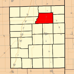
 Location in Iroquois County |
|
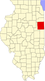
 Iroquois County's location in Illinois |
|
| Coordinates: 40°54′04″N 87°44′18″W / 40.90111°N 87.73833°WCoordinates: 40°54′04″N 87°44′18″W / 40.90111°N 87.73833°W | |
| Country | United States |
| State | Illinois |
| County | Iroquois |
| Established | September 1857 |
| Area | |
| • Total | 54.41 sq mi (140.9 km2) |
| • Land | 54.22 sq mi (140.4 km2) |
| • Water | 0.19 sq mi (0.5 km2) 0.35% |
| Elevation | 623 ft (190 m) |
| Population (2010) | |
| • Estimate (2016) | 904 |
| • Density | 17.4/sq mi (6.7/km2) |
| Time zone | CST (UTC-6) |
| • Summer (DST) | CDT (UTC-5) |
| ZIP codes | 60912, 60931, 60951, 60970 |
| FIPS code | 17-075-47293 |
Martinton Township is one of twenty-six townships in Iroquois County, Illinois, USA. As of the 2010 census, its population was 943 and it contained 460 housing units. Buchanan Township formed from a portion of Papineau Township, then known as Wygant Township, in September 1857; its name was changed to Martinton Township on an unknown date.
According to the 2010 census, the township has a total area of 54.41 square miles (140.9 km2), of which 54.22 square miles (140.4 km2) (or 99.65%) is land and 0.19 square miles (0.49 km2) (or 0.35%) is water.
The township contains these four cemeteries: Greentown, Mount Olivet, Old Burg and Teege.
...
Wikipedia
