Mars Hill, Maine
| Mars Hill, Maine | |
|---|---|
| Town | |

|
|
 Location of Mars Hill, Maine |
|
| Coordinates: 46°33′35″N 67°51′07″W / 46.55972°N 67.85194°WCoordinates: 46°33′35″N 67°51′07″W / 46.55972°N 67.85194°W | |
| Country | United States |
| State | Maine |
| County | Aroostook |
| Incorporated | 1867 |
| Area | |
| • Total | 35.20 sq mi (91.17 km2) |
| • Land | 35.13 sq mi (90.99 km2) |
| • Water | 0.07 sq mi (0.18 km2) |
| Elevation | 607 ft (185 m) |
| Population (2010) | |
| • Total | 1,493 |
| • Estimate (2012) | 1,475 |
| • Density | 42.5/sq mi (16.4/km2) |
| Time zone | Eastern (UTC-5) |
| • Summer (DST) | Eastern (UTC-4) |
| ZIP code | 04758 |
| Area code(s) | 207 |
| FIPS code | 23-43710 |
| GNIS feature ID | 0582582 |
| Website | www |
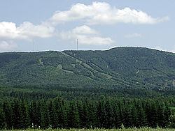
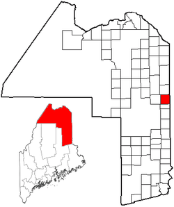
Mars Hill is a town in Aroostook County, Maine, United States, nestled at the foot of Mars Hill Mountain. The town lies less than one mile from the border with New Brunswick, Canada. The region is mainly agricultural. The population was 1,493 at the time of the 2010 census.
The town of Mars Hill is named for Hezekiah Mars, who camped for three years at the base of Mars Hill Mountain. In 1834, the first industry was cutting timber, particularly trees for masts. Farming later became important.
Following the end of the Aroostook War in 1839, a boundary line between Maine and New Brunswick was cleared and iron markers were put in place three years later.
The first mill opened at Rocky Brook in 1856.
In 1860, the first school was established for the community of Mars Hill. Further development of the community was delayed until after the American Civil War.
The Bangor and Aroostook Railroad arrived in 1892, allowing shipment of local produce to distant markets.
In 1906, the White Mountain Telephone Company, later known as the Aroostook Telephone & Telegraph Company, opened a new office in Mars Hill.
A six-bed community hospital was established in 1912.
In 1922, an intense fire devastated the business district in town. Mars Hill businesses were promptly rebuilt.
In 1937 the Walter T.A. Hansen Memorial Library was opened.
In the 1960s, Big Rock Ski Area was founded on Mars Hill Mountain.
In 2006, Maine's first wind farm was installed along the top and northern side of Mars Hill Mountain.
During and after World War II, the Mars Hill and surrounding economies were dominated by military spending. In 1947, the Limestone Army Air Field was built in Limestone. It opened in 1953 and was renamed the Loring Air Force Base. Aroostook County was chosen due to its strategic location as the closest point in the continental United States to Europe. The 1991 Base Realignment and Closure Commission recommended closure of Loring and the base closed in 1994.
...
Wikipedia
