Mapungubwe National Park
| Mapungubwe National Park | |
|---|---|
|
IUCN category II (national park)
|
|

Mapungubwe Hill
|
|
|
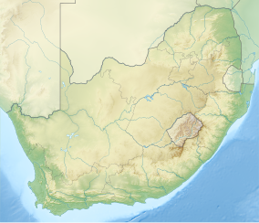
Location of the park
|
|
| Location | Limpopo, South Africa |
| Nearest city | Musina |
| Coordinates | 22°15′S 29°12′E / 22.250°S 29.200°ECoordinates: 22°15′S 29°12′E / 22.250°S 29.200°E |
| Area | 280 square kilometres (110 sq mi) |
| Established | 1995 |
| Governing body | South African National Parks |
| World Heritage Site | 2003 |
| www |
|
Mapungubwe National Park is a national park in Limpopo Province, South Africa. It is located by the Kolope River, south of the confluence of the Limpopo and Shashe rivers and about 15 km to the NE of the Venetia Diamond Mine. It abuts on the border with Botswana and Zimbabwe, and forms part of the Greater Mapungubwe Transfrontier Conservation Area. It was established in 1995 and covers an area of over 28 000 hectares. The park protects the historical site of Mapungubwe Hill, which was the capital of the Kingdom of Mapungubwe, as well as the wildlife and riverine forests along the Limpopo River. The Mapungubwe Hill was the site of a community dating back to the Iron Age. Evidences have shown that it was a prosperous community. Archaeologists also uncovered the famous golden rhino figurine from the site. It is one of the few places in Africa that has both meerkats and Nile crocodiles.
Mapungubwe National Park is renowned for its scenic landscape. Unique sandstone formations, woodlands, riverine forest and baobab trees combine to give it a fascinating look.
Although the history of the Mapungubwe Cultural Landscape dates back 210 million years ago when one of the earliest plant-eating dinosaurs, Plateosauravus (Euskelosaurus), was known to have lived in the area. This section describes how Mapungubwe National Park became a national park.
The Mapungubwe area became a focus of agricultural research in the 1920s through the efforts of a prominent botanist, Dr. I.B. Pole Evans. Pole Evans was instrumental in the creation of the Botanical Survey Advisory Committee which was tasked with coordinating botanical research throughout the Union of South Africa. One of the network of botanical and research stations set up by the Botanical Survey was situated in the Mapungubwe area. In 1918 the government, at the request of General Smuts, set aside a block of nine farms in this area as a preserve for wildlife and natural vegetation. A few years later this became known as the Dongola Botanical Reserve.
...
Wikipedia

