Manning Park
| E.C. Manning Provincial Park | |
|---|---|
|
IUCN category II (national park)
|
|

Hiking the sub-alpine meadows in Manning Park.
|
|
|
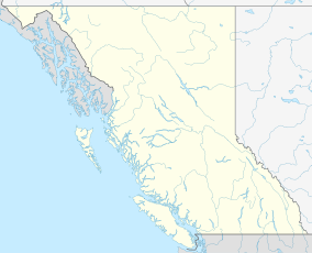
Location of Manning Park in British Columbia
|
|
| Location | British Columbia, Canada |
| Nearest town | Hope, British Columbia, Princeton, British Columbia, Eastgate, British Columbia, Sunshine Valley, British Columbia |
| Coordinates | 49°4′0″N 120°47′0″W / 49.06667°N 120.78333°WCoordinates: 49°4′0″N 120°47′0″W / 49.06667°N 120.78333°W |
| Area | 70,844 ha (175,060 acres) |
| Established | 1941 |
| Governing body | BC Parks |
E.C. Manning Provincial Park is a provincial park in British Columbia, Canada. It is usually referred to as Manning Park, although that nomenclature is also used to refer to the resort and ski area at the park's core. The park is 70,844 hectares (273.53 square miles).
The earliest human use of the land was by the coastal native peoples of British Columbia who, by travelling the route of the present day Skyline Trail accessed the Upper Similkameen Valley. The first European in the area was 1813 and was explored and mapped in 1827 by Archibald McDonald. Access to the area prior to the Great Depression was extremely limited due to a lack of any kind of developed roads or trails over the Cascade Mountains (other than the Dewdney Trail, far to the North). In 1929, the construction of a Road through the area was begun as a work project for the unemployed, but did not get completed. When the Canadian government began the internment of Japanese Canadians following the Attack on Pearl Harbor, one camp was formed in the present day Sunshine Valley, and the workers built the current Hope-Princeton highway, which was completed in 1949. The current route of the Hope-Princeton highway follows the route of the Allison Pass Trail, which was constructed in 1859-1860. The approximate route of the current Hope-Princeton highway was considered by the Great Northern Railroad, which led to much land being purchased along the predicted route prior to the formation of the park. The earliest form of the park was established in 1931 as the Three Brothers Mountain Reserve to prevent overgrazing, and eventually this became the three brothers game reserve in 1936. In 1941, the park was formed as Three Brothers Mountain Park, a Class A Provincial Park.
The park was soon thereafter named in memory of Ernest Callaway Manning, Chief Forester of British Columbia from 1936 to 1941 (not to be confused with Ernest C. Manning, Premier of Alberta from 1943 to 1968). Mr. Manning was killed in an airplane accident in 1941. During his time as Chief Forester he was instrumental in developing the idea of setting land aside for future generations to enjoy. It was the teamwork of Manning and Arthur Wellesley Gray, Minister of Lands from 1933 to 1944, that established Tweedsmuir Provincial Park, Hamber Provincial Park, Wells Gray Provincial Park, and E.C. Manning Provincial Park. Over the years, Manning Park has decreased in size, the most noticeable change being the park boundary in the east. Originally, the park included Similkameen Falls, but due to mine claims and private land ownership, the boundaries have since been moved more than four kilometers west.
...
Wikipedia

