Wells Gray Provincial Park
| Wells Gray Provincial Park | |
|---|---|
|
IUCN category Ib (wilderness area)
|
|

Helmcken Falls
|
|
|
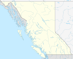
Location of Wells Gray Provincial Park in British Columbia
|
|
| Location | British Columbia, Canada |
| Nearest city | Clearwater |
| Coordinates | 52°19′26″N 120°08′59″W / 52.32389°N 120.14972°WCoordinates: 52°19′26″N 120°08′59″W / 52.32389°N 120.14972°W |
| Area | 5,250 km² |
| Established | 1939 |
| Visitors | 21,711 overnight campers (in 2003) |
| Governing body | BC Parks |
Wells Gray Provincial Park is a large wilderness park located in east-central British Columbia, Canada. The park protects most of the southern, and highest, regions of the Cariboo Mountains and covers 5,250 square kilometres (524,990 hectares or 1.3 million acres). It is British Columbia's fourth largest park, after Tatshenshini, Spatsizi and Tweedsmuir.
The boundaries of Wells Gray Park encompass 60 percent of the drainage basin of the Clearwater River and most water that originates in the park flows into this river. The northern two-thirds of the park is extremely rugged with relief ranging from Clearwater Lake at an elevation of 680 m (2,231 ft) to 2,946 m (9,665 ft) at an unnamed peak on the northern park boundary, 4.9 km (3.0 mi) west of Mount Pierrway. These summits are part of the Cariboo Mountains, and most of the east boundary of the park follows the mountain divide between drainage into the North Thompson River and into the Clearwater River. Individual mountain groups dominate the topography of the northern park region and are separated by deep glacially carved valleys, several of which contain large lakes such as Clearwater, Azure and Hobson. The ruggedness of its features has ensured that northern Wells Gray remains little known except to the hardiest of backpackers.
The southern third of Wells Gray Park is traversed by the Clearwater Valley Road, although large areas are accessible only by trail. The dominant topography features volcanic plateaus, lava flows and deep canyons which are crowned by several peaks over 2,300 m (7,546 ft) high. The waterfalls, for which Wells Gray is famous, usually result from the interaction of volcanic eruptions and glacial activity. The best known is Helmcken Falls, the fourth highest waterfall in Canada, which plunges 141 m (463 ft) over the edge of one of these volcanic plateaus.
Here are the eight highest mountains in Wells Gray Park:
...
Wikipedia

