Manistee County, Michigan
| Manistee County, Michigan | |
|---|---|
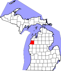
 Location in the U.S. state of Michigan |
|
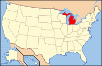
 Michigan's location in the U.S. |
|
| Founded | 1840, organized in 1855 |
| Seat | Manistee |
| Largest city | Manistee |
| Area | |
| • Total | 1,281 sq mi (3,318 km2) |
| • Land | 542 sq mi (1,404 km2) |
| • Water | 738 sq mi (1,911 km2), 58% |
| Population | |
| • (2010) | 24,733 |
| • Density | 46/sq mi (18/km²) |
| Congressional district | 1st |
| Time zone | Eastern: UTC-5/-4 |
| Website | www |
Manistee County is a county located in the U.S. state of Michigan. As of the 2010 census, the population was 24,733. The county seat is Manistee. The name "Manistee" is from an Ojibwe word first applied to the principal river of the county. The derivation is not certain, but it may be from ministigweyaa, "river with islands at its mouth".See also, List of Michigan county name etymologies and Kaministiquia River.
The county was set off in 1840 and organized in 1855.
There are thirteen recognized Michigan historical markers in the county:
The county government operates the jail, maintains rural roads, operates the major local courts, keeps files of deeds and mortgages, maintains vital records, administers public health regulations, and participates with the state in the provision of welfare and other social services. The county board of commissioners controls the budget but has only limited authority to make laws or ordinances. In Michigan, most local government functions — police and fire, building and zoning, tax assessment, street maintenance, etc. — are the responsibility of individual cities and townships.
(information as of February 2012)
According to the U.S. Census Bureau, the county has a total area of 1,281 square miles (3,320 km2), of which 542 square miles (1,400 km2) is land and 738 square miles (1,910 km2) (58%) is water. Manistee County is considered to be part of Northern Michigan.
Manistee County-Blacker Airport is approximately three miles (4.8 km) northeast of Manistee.
...
Wikipedia
