Manistee, Michigan
| Manistee, Michigan | |
|---|---|
| City | |
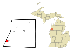
 Location of Manistee, Michigan |
|
| Location in the United States | |
| Coordinates: 44°14′37″N 86°19′17″W / 44.24361°N 86.32139°WCoordinates: 44°14′37″N 86°19′17″W / 44.24361°N 86.32139°W | |
| Country | United States |
| State | Michigan |
| County | Manistee |
| Area | |
| • Total | 4.47 sq mi (11.58 km2) |
| • Land | 3.29 sq mi (8.52 km2) |
| • Water | 1.18 sq mi (3.06 km2) |
| Elevation | 663 ft (202 m) |
| Population (2010) | |
| • Total | 6,226 |
| • Estimate (2012) | 6,173 |
| • Density | 1,892.4/sq mi (730.7/km2) |
| Time zone | Eastern (EST) (UTC-5) |
| • Summer (DST) | EDT (UTC-4) |
| ZIP code | 49660 |
| Area code(s) | 231 |
| FIPS code | 26-50720 |
| GNIS feature ID | 1620680 |
Manistee is a city in the U.S. state of Michigan. The population was 6,226 at the 2010 census. It is the county seat of Manistee County. The name "Manistee" is from an Ojibwe word first applied to the principal river of the county. The derivation is not certain, but it may be from ministigweyaa, "river with islands at its mouth". Other sources claim that it was an Ojibwe term meaning "spirit of the woods".
Manistee Township is located to the northeast of the city, but is politically separate. The city is located at the mouth of the Manistee River on Lake Michigan.
In 1751, a Jesuit Mission was established in Manistee. Missionaries visited Manistee in the early 19th century, and a Jesuit mission house is known to have been located on the NW shore of Manistee Lake in 1826. In 1832, a group of traders from Massachusetts built a log house up the Manistee River. However, they were soon driven off by the Ottawa. The first white settlement and sawmill was built there in 1841.
The village of Manistee was one of about 15 Ottawa villages along the shore of Lake Michigan in 1830. Much of the Manistee River Valley, including Manistee itself, was an Ottawa Reservation from 1836-1848.
The first permanent Euro-American settlement was made on April 16, 1841, when John Stronach and his son, Adam Stronach, arrived at the mouth of the Manistee River in a schooner loaded with fifteen men and equipment, and established a saw mill.
In 1846, the town was named "Manistee" but was a part of Ottawa County, with county offices 100 mies away at Grand Haven. After a series of new counties being drawn up, by 1855 it became part of a Manistee county that also included modern day Manistee, Wexford and Missaukee Counties.
...
Wikipedia

