Manikyadhara Falls
| Baba Budangiri | |
|---|---|
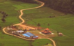
| village | |

Village near B.B.Hills
|
|
| Coordinates: 13°25′16″N 75°45′47″E / 13.421°N 75.763°ECoordinates: 13°25′16″N 75°45′47″E / 13.421°N 75.763°E | |
| Country | India |
| State | Karnataka |
| District | Chikmagalur |
| Elevation | 1,895 m (6,217 ft) |
| Languages | |
| • Official | Kannada |
| Time zone | IST (UTC+5:30) |
Baba Budangiri is a mountain in the Baba Budan range of the Western Ghats of India. Located in the Chikkamagaluru District of Karnataka, Baba Budangiri is known for its shrine to the Sufi saint Hazrat Dada Hayat Khalandar, a pilgrimage site for both Hindus and Muslims.
The main peaks in this range are the Mullayanagiri and Baba Budangiri (height 1895 m). Collectively, these peaks are known as Chandradrona Parvatha Shreni (Chandradrona Mountain Range) as they naturally form the shape of a crescent moon.
Mullayanagiri (also spelt Mullayangiri or Mullainagiri) is the highest peak in the Baba Budangiri range. With a height of 1930 m (6317 ft), it is the highest peak between the Himalayas and the Nilgiris. There is a famous trekking trail between Mullayanagiri and Baba Budangiri.
Baba Budangiri is 25 km north of Chikmagalur town and over 250 km from Bangalore. Mullayangiri can be reached around 15+ km distance from the Chikmagalur town on the way to Baba Budan Giri.
Manikyadhara Falls is near Kemmangundi of Chikmagalur district. It is on the Baba Budangiri Hills, which is a sacred place for Hindus and Muslims. It is one of the main attractions of Baba Budan Giri
It is approximately 40 km from Chickmagalur town.
Baba Budangiri Range is a range of mountains in the Western Ghats of Karnataka, India. The range, originally known as Chandra Drona Parvatha, takes its current name from the Dattapeeta Cave and 17th century Sufi saint Baba Budan. The Baba Budan Giri Range includes the highest peaks of Karnataka. Unique mountain flowers called kurinji blooms in these hill ranges once every 12 years. The last time this spectacle happened was in 2006.
...
Wikipedia

