Manas National Park
| Manas National Park মানস ৰাষ্ট্ৰীয় উদ্যান |
|
|---|---|
|
IUCN category II (national park)
|
|

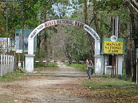
Main entrance of Manas National Park
|
|
| Location | Assam, India |
| Nearest city | Barpeta Road |
| Coordinates | 26°43′N 90°56′E / 26.717°N 90.933°ECoordinates: 26°43′N 90°56′E / 26.717°N 90.933°E |
| Area | 950 km2. |
| Established | 1990 |
| Visitors | NA (in NA) |
| Governing body | Ministry of Environment and Forests, Government of India |
| Website | http://www.manasassam.org |
| Type | Natural |
| Criteria | vii, ix, x |
| Designated | 1985 (9th session) |
| Reference no. | 338 |
| State Party |
|
| Region | Asia-Pacific |
| Endangered | 1992–2011 |
Manas National Park or Manas Wildlife Sanctuary (Pron:ˈmʌnəs) (Assamese: মানস ৰাষ্ট্ৰীয় উদ্যান, Manôx Rastriyô Udyan) is a national park, UNESCO Natural World Heritage site, a Project Tiger reserve, an elephant reserve and a biosphere reserve in Assam, India. Located in the Himalayan foothills, it is contiguous with the Royal Manas National Park in Bhutan. The park is known for its rare and endangered endemic wildlife such as the Assam roofed turtle, hispid hare, golden langur and pygmy hog. Manas is famous for its population of the wild water buffalo.
The name of the park is originated from the Manas River, which is named after the serpent goddess Manasa. The Manas river is a major tributary of Brahmaputra River, which passes through the heart of the national park.
The Manas National Park was declared a sanctuary on 1 October 1928 with an area of 360 km2. Manas bioreserve was created in 1973. Prior to the declaration of the sanctuary it was a reserved forest called Manas R.F. and North Kamrup R.F. It was used by the Cooch Behar royal family and Raja of Gauripur as a hunting reserve. In 1951 and 1955 the area was increased to 391 km2. It was declared a World Heritage site in December 1985 by UNESCO. Kahitama R.F. the Kokilabari R.F. and the Panbari R.F. were added in the year 1990 to form the Manas National Park. In 1992, UNESCO declared it as a world heritage site in danger due to heavy poaching and terrorist activities. On 25 February 2008 the area was increased to 950 km2. On 21 June 2011, it was removed from the List of World Heritage in Danger and was commended for its efforts in preservation.
...
Wikipedia

