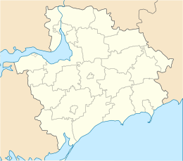
Mala Khortytsia
| Native name: Хо́ртиця | |
|---|---|
| Geography | |
| Location | Dnieper River |
| Coordinates | 47°49′N 35°6′E / 47.817°N 35.100°E |
| Area | 23.59 km2 (9.11 sq mi) |
| Length | 12.5 km (7.77 mi) |
| Width | 2.5 km (1.55 mi) |
| Highest elevation | 30 m (100 ft) |
| Highest point | N/A |
| Administration | |
|
Ukraine
|
|
| Region | Zaporizhia |
| District | Zaporizhia city (Voznesenivskyi District) |
Khortytsia (Ukrainian: Хо́ртиця, Khortytsia pronounced [ˈxɔrtɪt͡sʲa], Russian: Хо́ртица, Khortitsa, Polish: Chortyca) is the largest island in the River Dnieper, and is 12.5 kilometres (7.77 miles) long and up to 2.5 kilometres (1.55 miles) wide. The island forms part of the Khortytsya National Park. This historic site is located within the city limits of Zaporizhia,Ukraine.
The island has played an important role in the history of Ukraine, specially in the history of the Zaporozhian Cossacks. The island has unique flora and fauna, including oak groves, spruce woods, meadows, and steppe. The northern part of the island is very rocky and high (rising 30 m (98 ft) above the river bed) in comparison to the southern part, which is low, and often flooded by the waters of the Dnieper.
Zaporizhia (direct translation is "beyond the rapids") takes its name from an geographic area downstream of the Dnieper river pass the ninth rapid (see Dnieper Rapids). In the 1930s when the Dnieper Hydroelectric Station was built, these rapids were flooded. Only granite cliffs, rising to the height of 50 m (160 ft), testify to the original rocky terrain of the region.
Khortytsia has been continuously inhabited during the last five millennia. Other islands in the immediate vicinity also contain indications of intensive occupation during the Proto-Indo-European and Scythian periods. The island of Small Khortytsia is known for its Scythian remains and a derelict Cossack fortress. The islet of Sredeny Stih (to the northeast of Khortytsia), excavated during construction of the hydroelectric station in 1927, gave its name to the Sredny Stog culture.
...
Wikipedia


