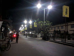
Mainaguri
|
Maynaguri ময়নাগুড়ি Mainaguri |
|
|---|---|
| City | |
 |
|
| Nickname(s): The Gateway of Dooars | |
| Location in West Bengal, India | |
| Coordinates: 26°33′50″N 88°49′12″E / 26.564°N 88.820°ECoordinates: 26°33′50″N 88°49′12″E / 26.564°N 88.820°E | |
| Country |
|
| State | West Bengal |
| District | Jalpaiguri |
| Elevation | 84 m (276 ft) |
| Population (2011) | |
| • Total | 30,490 |
| Languages | |
| • Official | Bengali, English |
| Time zone | IST (UTC+5:30) |
| PIN | 735224 |
| Lok Sabha constituency | Jalpaiguri |
| Vidhan Sabha constituency | Maynaguri |
| Website | jalpaiguri |
Mainaguri is a town and a municipality in Jalpaiguri district in the Indian state of West Bengal. It is known as the "Gate way of Dooars" and is a regionally significant tourist destination for its temple to Shiva & nearby Gorumara Wildlife Sanctuary.
Mainaguri is located at 26°34′N 88°49′E / 26.57°N 88.82°E. It has an average elevation of 84 metres (275 feet).
Mainaguri is about 10 km north-east of Jalpaiguri and 50 km from Siliguri. Local attractions include Jalpesh Shiva Temple, Gorumara National Park and Chapramari Wildlife Sanctuary. The nearest airport is Civil Enclave Bagdogra, and the nearest railway station is New Mainaguri.
Five roads connect Mainaguri with
As of 2001[update] India census, Mainaguri had a population of 27,086. Males constitute 51% of the population and females 49%. Mainaguri has an average literacy rate of 75%, higher than the national average of 59.5%: male literacy is 80%, and female literacy is 70%. In Mainaguri, 11% of the population is under 6 years of age.
Maynaguri provides a quality education to its surrounding students. Students of this area repeatedly do well in board exams. This town provides higher education on general studies. In the near future a technical college and an ITI will be introduced.
...
Wikipedia

