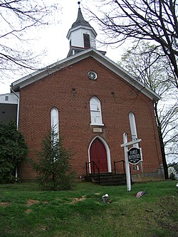
Macungie
| Borough of Macungie | |
|---|---|
| Borough | |

Macungie
|
|
 Location of Macungie in Lehigh County, Pennsylvania. |
|
 Location of Pennsylvania in the United States |
|
| Coordinates: 40°30′50″N 75°33′09″W / 40.51389°N 75.55250°WCoordinates: 40°30′50″N 75°33′09″W / 40.51389°N 75.55250°W | |
| Country | United States |
| State | Pennsylvania |
| County | Lehigh |
| Area | |
| • Total | 0.99 sq mi (2.56 km2) |
| • Land | 0.99 sq mi (2.56 km2) |
| • Water | 0.00 sq mi (0.00 km2) |
| Elevation | 400 ft (100 m) |
| Population (2010) | |
| • Total | 3,074 |
| • Estimate (2016) | 3,149 |
| • Density | 3,184.02/sq mi (1,229.25/km2) |
| Time zone | EST (UTC-5) |
| • Summer (DST) | EDT (UTC-4) |
| ZIP code | 18062 |
| Area code(s) |
610 Exchanges: 965, 966, 967 |
| FIPS code | 42-46392 |
| Website | www |
Macungie (pronounced ma-CUN-gee) is the second oldest borough in Lehigh County, Pennsylvania, United States and a suburb of Allentown, Pennsylvania in the Lehigh Valley region. Macungie is included in the Allentown-Bethlehem-Easton, PA-NJ Metropolitan Statistical Area, which is also included in the New York City-Newark, New Jersey, NY-NJ-CT-PA Combined Statistical Area.
Macungie was founded as Millerstown in 1776 by Peter Miller. On November 15, 1857, the village of Millerstown was incorporated as a borough.
During Fries's Rebellion in 1800, the U.S. Marshal began arresting people for tax resistance, and arrests were made without much incident until the marshal reached Millerstown, where a crowd formed to protect a man from arrest. Failing to make that arrest, the marshal arrested a few others and returned to Bethlehem, Pennsylvania with his prisoners. Two separate groups of rebels independently vowed to liberate the prisoners and marched on Bethlehem. The militia prevailed, and John Fries, leader of the rebellion, and others were arrested.
In 1875, the borough was renamed Macungie to avoid confusion with another town by the same name: Millerstown in Perry County, Pennsylvania. Macungie lies in the eastern part of the historic Pennsylvania Dutch Country.
...
Wikipedia
