Machov
| Machov | |
|---|---|
| Market town | |

Machov – view from Poland
|
|
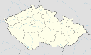
| Location in the Czech Republic | |
| Coordinates: 50°29′20″N 16°16′14″E / 50.48889°N 16.27056°ECoordinates: 50°29′20″N 16°16′14″E / 50.48889°N 16.27056°E | |
| Country |
|
| Region | Hradec Králové Region |
| District | Náchod District |
| Time zone | CET (UTC+1) |
| • Summer (DST) | CEST (UTC+2) |
Machov is a market town situated in the Czech Republic and in the Hradec Králové Region. It has around 1,100 inhabitants.
It lies just next to the border with Poland. Machov has always had a majority of Czech inhabitants although strong ties with Polish and German borderlands existed. Machov originally lay entirely on a left side of the brook Židovka but it was later merged with other villages, now administrative parts of Machov. Nízká Srbská on the right hand side of Židovka, Machovská Lhota further along the brook and also Bělý. Machov lies in a valley of the brook Židovka and under a dominant mountain Bor, which is one of the famous Table Mountains in Poland. Close to Machov are also Broumov Cliffs, which are sand-stone towers perfect for rock climbing.
Near Machov, there are important resources of drinking water thanks to a geological substratum that filters rain water. The same minerals also formed amazing sand-stone rock towers of already mentioned Broumov Cliffs and Table Mountains.
The first written note is from 1354 and the first note of Machov as a market town is from 1405, when it was a part of Náchod county. A church of St. Wenceslas from 1675 stands at the place of a removed wooden church established in 1354. There is a baroque Marian column on the square from 1761. A protected lime tree (Tilia cordata) with estimated age of 500 years grows near house number 26. It is the oldest tree in the whole region and the specimen is a national emblem of the Czech and Slovak republic.
Machov is twinned with:
...
Wikipedia

