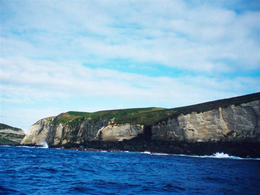
Macauley Island
Macauley Island is a volcanic island in New Zealand's Kermadec Islands, approximately halfway between New Zealand's North Island and Tonga in the southwest Pacific Ocean. Its co-ordinates are 30°14′S 178°26′W / 30.233°S 178.433°WCoordinates: 30°14′S 178°26′W / 30.233°S 178.433°W
Macauley Island is the second-largest of the Kermadec islands (after Raoul Island), and covers an area of 3.06 km2 (1.181 sq mi), including neighbouring Haszard Island, which is 220 m (722 ft) to the east and about 5 ha (12 acres) in area. The island's topography is simple, being a single high-sided plateau, with the soft rock of the island prone to the formation of deep water channels. Macauley's highest point is 238 m (781 ft) Mount Haszard, and it forms part of the rim of a caldera centred 8 km (5 mi) to the north-west, atop a large submarine volcano. The volcano's last eruption was in 4360 BC ± 200 years.
...
Wikipedia

