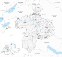
Mühledorf, Bern
| Mühledorf | ||
|---|---|---|
 |
||
|
||
| Coordinates: 46°50′N 7°32′E / 46.833°N 7.533°ECoordinates: 46°50′N 7°32′E / 46.833°N 7.533°E | ||
| Country | Switzerland | |
| Canton | Bern | |
| District | Bern-Mittelland | |
| Government | ||
| • Mayor | Eric von Graffenried | |
| Area | ||
| • Total | 2.28 km2 (0.88 sq mi) | |
| Elevation | 605 m (1,985 ft) | |
| Population (Dec 2016) | ||
| • Total | 264 | |
| • Density | 120/km2 (300/sq mi) | |
| Postal code | 3116 | |
| SFOS number | 0875 | |
| Surrounded by | Gelterfingen, Gerzensee, Kirchdorf, Kirchenthurnen, Mühlethurnen | |
| Website |
www SFSO statistics |
|
Mühledorf is a municipality in the Bern-Mittelland administrative district in the canton of Bern in Switzerland.
Mühledorf is first mentioned in 1364 as Mülidorf.
During the Middle Ages the village was part of the barony of Kramburg. In 1373 the village was donated to the Münchenbuchsee Commandery. In 1528, Bern accepted the new faith of the Protestant Reformation and suppressed the Commandery. Mühledorf came under Bernese rule and in 1533 was assigned to the court of Gelterfingen in the district of Seftigen created. The village has always been part of the parish of Kirchdorf.
The Gürbe and Müsche river projects of 1855-1911 drained the swampy valley floor and opened up farmland. It also made it possible to build roads to Belp and Rümligen. Today, agriculture is still the main industry. However, around two-thirds of the work force commute to jobs in nearby towns and cities.
Mühledorf has an area of 2.28 km2 (0.88 sq mi). As of 2012, a total of 2 km2 (0.77 sq mi) or 87.7% is used for agricultural purposes, while 0.12 km2 (0.046 sq mi) or 5.3% is forested. The rest of the municipality is 0.16 km2 (0.062 sq mi) or 7.0% is settled (buildings or roads), 0.01 km2 (2.5 acres) or 0.4% is either rivers or lakes.
During the same year, housing and buildings made up 5.3% and transportation infrastructure made up 1.8%. All of the forested land area is covered with heavy forests. Of the agricultural land, 65.4% is used for growing crops and 20.2% is pasturage, while 2.2% is used for orchards or vine crops. All the water in the municipality is flowing water.
The entire municipality and the village of Mühledorf are located on a terrace above the Gürbetal (Gürbe valley) and stretching to Gerzensee lake.
...
Wikipedia


