Kirchdorf, Bern
| Kirchdorf | |
|---|---|

Richly decorated farm house and village church in Kirchdorf village
|
|
| Coordinates: 46°49′N 7°33′E / 46.817°N 7.550°ECoordinates: 46°49′N 7°33′E / 46.817°N 7.550°E | |
| Country | Switzerland |
| Canton | Bern |
| District | Bern-Mittelland |
| Government | |
| • Mayor | Paul Messerli |
| Area | |
| • Total | 6.13 km2 (2.37 sq mi) |
| Elevation | 611 m (2,005 ft) |
| Population (Dec 2015) | |
| • Total | 956 |
| • Density | 160/km2 (400/sq mi) |
| Postal code | 3116 |
| SFOS number | 0872 |
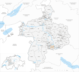
| Surrounded by | Burgistein, Gerzensee, Jaberg, Kienersrüti, Lohnstorf, Mühledorf, Mühlethurnen, Noflen, Uttigen, Wichtrach |
| Website |
www SFSO statistics |
Kirchdorf is a municipality in the Bern-Mittelland administrative district in the canton of Bern in Switzerland.
Kirchdorf is first mentioned in 1228 as Chilthorf.
The oldest trace of a settlement in the area are several La Tène graves near the current cemetery. A prehistoric earthwork in the Gestelenwald may have had a village near it. During the Middle Ages a number of local nobles and patricians owned rights or land in the village. From the 13th until the 15th century several monasteries bought or received much of the village. In 1507-08 Jakob von Wattenwyl acquired all the scattered rights and land holdings and combined them into a single Herrschaft. He than sold the territory and Kirchdorf passed through a number of owners. In 1645, the village council acquired the Kirchdorf court, which they then sold to Bern for 1,000 pounds.
The village church of St. Ursus was built during the Middle Ages. It first appears in a historical record in 1228 as the center of a large parish. Today it is still the parish church for several surrounding municipalities. The current church was built in 1872-74, after the medieval church was destroyed in a fire.
The village is located between the Emmental and Schwarzburg regions and has always made a little money off the trade route. Beginning in the 1970s the population began increasing as commuters moved into Kirchdorf. Today, about two-thirds of the workers commute to jobs in other towns and cities. The local economy is based on agriculture, small businesses, gravel mining and a regional landfill. The Tannacker home and workshop for the handicapped also provides some jobs.
Kirchdorf has an area of 6.13 km2 (2.37 sq mi). As of 2012, a total of 4.16 km2 (1.61 sq mi) or 67.9% is used for agricultural purposes, while 1.09 km2 (0.42 sq mi) or 17.8% is forested. The rest of the municipality is 0.7 km2 (0.27 sq mi) or 11.4% is settled (buildings or roads), 0.11 km2 (27 acres) or 1.8% is either rivers or lakes and 0.04 km2 (9.9 acres) or 0.7% is unproductive land.
...
Wikipedia


