Jaberg
| Jaberg | ||
|---|---|---|
|
||
| Coordinates: 46°49′N 7°34′E / 46.817°N 7.567°ECoordinates: 46°49′N 7°34′E / 46.817°N 7.567°E | ||
| Country | Switzerland | |
| Canton | Bern | |
| District | Bern-Mittelland | |
| Government | ||
| • Mayor | Rolf Peter | |
| Area | ||
| • Total | 1.32 km2 (0.51 sq mi) | |
| Elevation | 540 m (1,770 ft) | |
| Population (Dec 2015) | ||
| • Total | 252 | |
| • Density | 190/km2 (490/sq mi) | |
| Postal code | 3629 | |
| SFOS number | 0868 | |
| Surrounded by | Kiesen, Kirchdorf, Uttigen, Wichtrach | |
| Website |
www SFSO statistics |
|
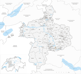
Jaberg is a municipality in the Bern-Mittelland administrative district in the canton of Bern in Switzerland.
Jaberg is first mentioned in 1259 as Jagberc.
The oldest trace of a settlement in the area is a Hallstatt burial mound. During the Early Middle Ages the same area was used as a cemetery. A small hill fort from the same era indicates that there was probably a village near the Jabergwald. During the Middle Ages wooden castle was built near the Aare ferry. According to Konrad Justinger it was destroyed by Bern in 1286. The village was probably owned by the Lords of Krauchtal until the 15th century, when it was acquired by a noble family from Bern. The village passed through several landowners before being acquired by Bern city around 1528, when Bern adopted the new faith of the Protestant Reformation.
Today the village is mostly rural and agrarian with most of the farms raising livestock. A gravel pit and a regional landfill provide additional jobs. Since the 1970s it has slowly been transformed into a bedroom community and now about four-fifths of the population commute to jobs in nearby towns and cities.
Jaberg has an area of 1.32 km2 (0.51 sq mi). As of 2012, a total of 0.68 km2 (0.26 sq mi) or 51.5% is used for agricultural purposes, while 0.3 km2 (0.12 sq mi) or 22.7% is forested. The rest of the municipality is 0.24 km2 (0.093 sq mi) or 18.2% is settled (buildings or roads), 0.06 km2 (15 acres) or 4.5% is either rivers or lakes.
During the same year, housing and buildings made up 6.1% and transportation infrastructure made up 4.5%. Power and water infrastructure as well as other special developed areas made up 7.6% of the area A total of 18.9% of the total land area is heavily forested and 3.8% is covered with orchards or small clusters of trees. Of the agricultural land, 34.8% is used for growing crops and 13.6% is pasturage, while 3.0% is used for orchards or vine crops. All the water in the municipality is flowing water.
...
Wikipedia


