Müden (Mosel)
| Müden | ||
|---|---|---|
 |
||
|
||
| Coordinates: 50°11′12″N 7°20′25″E / 50.18667°N 7.34028°ECoordinates: 50°11′12″N 7°20′25″E / 50.18667°N 7.34028°E | ||
| Country | Germany | |
| State | Rhineland-Palatinate | |
| District | Cochem-Zell | |
| Municipal assoc. | Cochem | |
| Government | ||
| • Mayor | Franz-Josef Thönnes | |
| Area | ||
| • Total | 7.50 km2 (2.90 sq mi) | |
| Elevation | 90 m (300 ft) | |
| Population (2015-12-31) | ||
| • Total | 648 | |
| • Density | 86/km2 (220/sq mi) | |
| Time zone | CET/CEST (UTC+1/+2) | |
| Postal codes | 56254 | |
| Dialling codes | 02672 | |
| Vehicle registration | COC | |
| Website | www.mueden-mosel.de | |
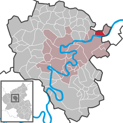
Müden an der Mosel is an Ortsgemeinde – a municipality belonging to a Verbandsgemeinde, a kind of collective municipality – and a tourism resort in the Cochem-Zell district in Rhineland-Palatinate, Germany. It belongs to the Verbandsgemeinde of Cochem.
Müden lies within the winegrowing country on the sunny side of the Moselle valley. It borders in the north on the Eifel and in the south on the Moselle, with the Hunsrück over the other side. The wine, the Moselle, which has been built into a major navigable waterway, and the nearby castle, Burg Eltz, lend the place a special character.
Also belonging to the municipality, whose main centre is also called Müden, is the outlying centre of Müdenerberg with a sporting ground, a composting lot and a chapel.
A Roman settlement of Celtic origin, called Modinum, is known from many archaeological finds. The village had its first documentary mention about 585. Trier’s centuries-long lordship ended with the occupation of the lands on the Rhine’s left bank by French Revolutionary troops in 1794. In 1815 Müden was assigned to the Kingdom of Prussia at the Congress of Vienna. After the Second World War, Müden belonged to the French zone of occupation. Since 1946, it has been part of the then newly founded state of Rhineland-Palatinate.
...
Wikipedia


