Lyons, Nebraska
| Lyons, Nebraska | |
|---|---|
| City | |

Houses and streets in Lyons
|
|
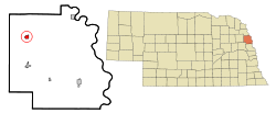
 Location of Lyons, Nebraska |
|
| Coordinates: 41°56′10″N 96°28′20″W / 41.93611°N 96.47222°WCoordinates: 41°56′10″N 96°28′20″W / 41.93611°N 96.47222°W | |
| Country | United States |
| State | Nebraska |
| County | Burt |
| Area | |
| • Total | 0.69 sq mi (1.79 km2) |
| • Land | 0.68 sq mi (1.76 km2) |
| • Water | 0.01 sq mi (0.03 km2) |
| Elevation | 1,293 ft (394 m) |
| Population (2010) | |
| • Total | 851 |
| • Estimate (2016) | 814 |
| • Density | 1,200/sq mi (480/km2) |
| Time zone | Central (CST) (UTC-6) |
| • Summer (DST) | CDT (UTC-5) |
| ZIP code | 68038 |
| Area code(s) | 402 |
| FIPS code | 31-29855 |
| GNIS feature ID | 0830977 |
Lyons is a city in Burt County, Nebraska, United States. The population was 851 in the 2010 census. The city is named after its founder.
Lyons was founded in 1880 by Waldo Lyons, and named for him.
The founder was against the consumption of alcoholic beverages, and prohibition remained in force until overcome by a public referendum in 1968.
Lyons is located at 41°56′10″N 96°28′20″W / 41.93611°N 96.47222°W (41.936110, -96.472255). According to the United States Census Bureau, the city has a total area of 0.69 square miles (1.79 km2), of which, 0.68 square miles (1.76 km2) is land and 0.01 square miles (0.03 km2) is water.
Lyons is on US Route 77, south of the Omaha Indian Reservation. It is west of the Missouri River.
As of the census of 2010, there were 851 people, 395 households, and 228 families residing in the city. The population density was 1,251.5 inhabitants per square mile (483.2/km2). There were 457 housing units at an average density of 672.1 per square mile (259.5/km2). The racial makeup of the city was 96.7% White, 0.1% African American, 0.9% Native American, 0.2% Pacific Islander, 1.3% from other races, and 0.7% from two or more races. Hispanic or Latino of any race were 3.2% of the population.
...
Wikipedia
