Lyantor
| Lyantor (English) Лянтор (Russian) |
|
|---|---|
| - Town - | |
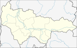
 Location of Khanty-Mansi Autonomous Okrug in Russia |
|
|
|
|
|
|
|
|
|
|
| Administrative status (as of November 2012) | |
| Country | Russia |
| Federal subject | Khanty-Mansi Autonomous Okrug |
| Administrative district | Surgutsky District |
| Municipal status (as of June 2014) | |
| Municipal district | Surgutsky Municipal District |
| Urban settlement | Lyantor Urban Settlement |
| Administrative center of | Lyantor Urban Settlement |
| Statistics | |
| Population (2010 Census) | 38,992 inhabitants |
| Time zone | YEKT (UTC+05:00) |
| Founded | 1967 |
| Town status since | 1992 |
| Postal code(s) | 628449 |
|
|
|
| on | |
Lyantor (Russian: Лянто́р) is a town in Surgutsky District of Khanty–Mansi Autonomous Okrug, Russia, located on the Pim River (Ob's tributary), 625 kilometers (388 mi) northeast of Khanty-Mansiysk, the administrative center of the autonomous okrug. Population: 38,992 (2010 Census);33,011 (2002 Census);22,071 (1989 Census).
It was established in 1967 in place of a fishing settlement of Pim due to discovery of oil and natural gas deposits in its vicinity. It was granted work settlement status in 1980 and town status in 1992.
Within the framework of administrative divisions, Lyantor is subordinated to Surgutsky District. As a municipal division, the town of Lyantor is incorporated within Surgutsky Municipal District as Lyantor Urban Settlement.
The economy is based on oil extraction.
...
Wikipedia


