Ludlow (town), Vermont
| Ludlow, Vermont | |
|---|---|
| Town | |

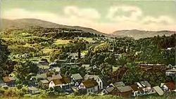
Ludlow in 1906
|
|
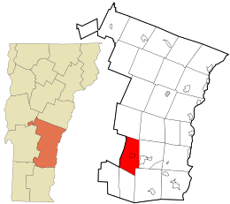
 Location in Windsor County and the state of Vermont. |
|
| Location in the United States | |
| Coordinates: 43°23′45″N 72°42′2″W / 43.39583°N 72.70056°WCoordinates: 43°23′45″N 72°42′2″W / 43.39583°N 72.70056°W | |
| Country | United States |
| State | Vermont |
| County | Windsor |
| Area | |
| • Total | 35.7 sq mi (92.5 km2) |
| • Land | 35.2 sq mi (91.1 km2) |
| • Water | 0.5 sq mi (1.4 km2) |
| Elevation | 1,067 ft (325 m) |
| Population (2010) | |
| • Total | 1,963 |
| • Density | 55/sq mi (21/km2) |
| Time zone | Eastern (EST) (UTC-5) |
| • Summer (DST) | EDT (UTC-4) |
| ZIP code | 05149 |
| Area code(s) | 802 |
| FIPS code | 50-41275 |
| GNIS feature ID | 1462138 |
| Website | www |
Ludlow is a town in Windsor County, Vermont, United States. The population was 1,963 at the 2010 census. Ludlow is the home of Okemo Mountain, a popular ski resort. It was named after Ludlow, Massachusetts which is less than 100 miles away.
According to the United States Census Bureau, the town has a total area of 35.7 square miles (92.5 km2), of which 35.2 square miles (91.1 km2) is land and 0.54 square miles (1.4 km2), or 1.46%, is water. Within the town is located the incorporated village of Ludlow. Lake Rescue, a popular lake for recreational activities, is located about three miles north of the town center along Vermont Route 100. Vermont Route 103 passes east–west through the center of town.
As of the census of 2000, there were 2,449 people, 1,060 households, and 658 families residing in the town. The population density was 69.4 people per square mile (26.8/km2). There were 3,001 housing units at an average density of 85.1/sq mi (32.9/km2). The racial makeup of the town was 98.41% White, 0.20% Black or African American, 0.16% Native American, 0.41% Asian, 0.20% from other races, and 0.61% from two or more races. Hispanic or Latino of any race were 0.24% of the population.
...
Wikipedia

