Lough Arrow
| Lough Arrow Loch Arbhach |
|
|---|---|

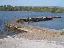
Toward the Bricklieve Mountains
|
|
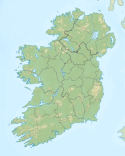
| Location | County Sligo, County Roscommon |
| Coordinates | 54°3′12″N 8°19′15″W / 54.05333°N 8.32083°WCoordinates: 54°3′12″N 8°19′15″W / 54.05333°N 8.32083°W |
| Lake type | mesotrophic |
| Primary inflows | Mainly spring-fed, also some streams |
| Primary outflows | Unshin River |
| Catchment area | 65.76 km2 (25 sq mi) |
| Basin countries | Ireland |
| Max. length | 6 km (3.7 mi) |
| Max. width | 2 km (1.2 mi) |
| Surface area | 12.47 km2 (4.81 sq mi) |
| Average depth | 9 m (30 ft) |
| Max. depth | 33 m (108 ft) |
| Surface elevation | 53 m (174 ft) |
| Islands | 4 |
| References | |
Lough Arrow (Irish: Loch Arbhach) is a freshwater lake in the northwest of Ireland. This large, scenic lake covers an area of 12.47 square kilometres (4.8 sq mi) and lies mostly in County Sligo with a smaller part in County Roscommon. It is a popular trout fishing lake.
Lough Arrow lies mostly in south County Sligo about 24 kilometres (15 mi) southeast of Sligo and 6 km (4 mi) northwest of Boyle. The Bricklieve Mountains rise west of the lake.
Lough Arrow is about 6 km (3.7 mi) long from north to south and 2 km (1.2 mi) wide. The lake has four islands: Annaghgowla, Inishmore, Inishbeg and Muck.
Lough Arrow is a mesotrophic lake. It is fed mainly by springs but also by a number of streams entering on the lake's western and southern sides. The lake drains north into the Unshin River. The mean lake depth is 9 m (30 ft) with a maximum depth of 33 m (108 ft).
Fish present in Lough Arrow include brown trout, perch, roach, three-spined stickleback, pike, rudd, bream and the critically endangered European eel. A number of duck species winter at the lake including mallard, wigeon, teal, red-breasted merganser, tufted duck, pochard and goldeneye. Other bird species found at the lake include great crested grebe, little grebe, cormorant and mute swan.
...
Wikipedia

