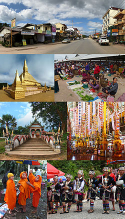
Louang Namtha Province
|
Luang Namtha ຫລວງນໍ້າທາ |
|
|---|---|
| Province | |
 |
|
 Map of Luang Namtha Province |
|
 Location of Luang Namtha Province in Laos |
|
| Coordinates: 20°57′25″N 101°23′42″E / 20.956944°N 101.395°ECoordinates: 20°57′25″N 101°23′42″E / 20.956944°N 101.395°E | |
| Country |
|
| Capital | Luang Namtha |
| Area | |
| • Total | 9,325 km2 (3,600 sq mi) |
| Population (2015 census) | |
| • Total | 175,753 |
| • Density | 19/km2 (49/sq mi) |
| Time zone | UTC+07 |
| ISO 3166 code | LA-LM |
Luang Namtha (Lao ຫລວງນໍ້າທາ, literally "Royal Sugar Palm" or "Royal Green River") is a province of Laos located in the north of the country. From 1966 to 1976 it formed, together with Bokeo, the province of Houakhong. Luang Namtha Province covers an area of 145,289 square kilometres (56,096 sq mi). Its provincial capital is Luang Namtha. The province borders with Yunnan, China to the north, Oudomxai Province to the east and southeast, Bokeo Province to the southwest, and Shan State, Burma to the northwest.
The province contains the Nam Ha National Biodiversity Conservation Area and is one of the main sugar cane and rubber producing areas of Laos with numerous plantations. There are some 20 temples in Muang Sing, including Wat Sing Jai and Wat Namkeo. The anthropological Luang Namtha Museum is located in Luang Namtha.
The history of Luang Namtha Province is traced to inhabitants who lived here about 6,000 years ago, evidenced by archaeological finds of stone implements discovered from the Nam Jook River Valley in Vieng Phoukha. The Xieng Khaeng Chronicles also mention existence of Xieng Khaeng town in the early 15th century, on the shores of the Mekong River. As its prosperity increased it became a vassal of the Lanna Kingdom of Northern Thailand until the early 16th century. However, from the mid-16th until the early 19th century it came under the control of Burma. In the first half of the 19th century, it was under Siamese rule and was involved in many battles. In 1885, Chao Fa Silinor, supported by 1,000 Tai-Lue people took control of Muang Sing, attracted by its large agricultural lands.
However, in 1890, the Tai Yuan resurrected Nam Tha Valley for a short period of two years, and thus Muang Houa Tha came to be reestablished. It was during this period that Vat Luang Korn, one of Luang Namtha’s biggest temples, was built in 1892. In 1894, the French, British and Siamese colonists, decided that this province will be administered by the French. The border was also redrawn with the Mekong River serving as the northern border (along its northern reaches of Muang Sing to Chiang Saen) between French colony of Indochina and British colony of Burma. This was followed by migration of Tai-Dam from Sip Song Chou Tai from north western Viet Nam who settled in the newly created Tong Jai Village, on the east bank of the Nam Tha River. Concurrently other ethnic groups such as Tai-Dam, Tai-Neua, Tai-Kao, Akha, Lanten, Yao and Lahu from Sipsongpanna in Burma and northwest Vietnam also migrated to the province. During French colonial rule, the provincial capital of Luang Namtha was the heart of the Sipsongpana civilization, which later moved to Yunnan Province in southern China.
...
Wikipedia
