Lost Springs, Kansas
| Lost Springs, Kansas | |
|---|---|
| City | |
 Location within Marion County and Kansas |
|
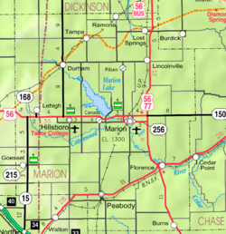
 KDOT map of Marion County (legend) |
|
| Coordinates: 38°33′59″N 96°57′55″W / 38.56639°N 96.96528°WCoordinates: 38°33′59″N 96°57′55″W / 38.56639°N 96.96528°W | |
| Country | United States |
| State | Kansas |
| County | Marion |
| Platted | 1887 |
| Incorporated | 1904 |
| Government | |
| • Type | Mayor–Council |
| • Mayor | Tish Keesling |
| • City Clerk | Shelly Wirtz |
| Area | |
| • Total | 0.23 sq mi (0.60 km2) |
| • Land | 0.23 sq mi (0.60 km2) |
| • Water | 0 sq mi (0 km2) |
| Elevation | 1,493 ft (455 m) |
| Population (2010) | |
| • Total | 70 |
| • Estimate (2015) | 67 |
| • Density | 300/sq mi (120/km2) |
| Time zone | CST (UTC-6) |
| • Summer (DST) | CDT (UTC-5) |
| ZIP code | 66859 |
| Area code | 785 |
| FIPS code | 20-42825 |
| GNIS feature ID | 0477142 |
|
|
|
Lost Springs is a city in Marion County, Kansas, United States. It was named for the old lost spring near the city. As of the 2010 census, the city population was 70.
For many millennia, the Great Plains of North America was inhabited by nomadic Native Americans. From the 16th century to 18th century, the Kingdom of France claimed ownership of large parts of North America. In 1762, after the French and Indian War, France secretly ceded New France to Spain, per the Treaty of Fontainebleau.
In 1802, Spain returned most of the land to France. In 1803, most of the land for modern day Kansas was acquired by the United States from France as part of the 828,000 square mile Louisiana Purchase for 2.83 cents per acre.
From the 1820s to the 1870s, one of the most significant land routes in the United States was the Santa Fe Trail. The "Lost Spring" was one of the favorite camping spots on the Santa Fe Trail because it generally had an ample supply of good water. It was located 15 miles west of Diamond Spring, which was a day's travel for a wagon train. The spring apparently got its name because it is a periodic spring, drying up at times for a week, a month, or even two years, so those visiting the site sometimes could not locate the spring on a return trip. A stage station was set up nearby in 1859 and was known as the Lost Springs Station, but no visible evidence remains of the station. The trail was active across Marion County from 1821 to 1866.
...
Wikipedia
