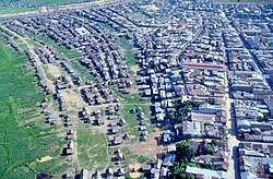
Loreto (Department of Peru)
| Loreto Region | ||
|---|---|---|
| Region | ||

Iquitos
|
||
|
||
 Location of the Loreto region in Peru |
||
| Coordinates: 4°00′S 74°19′W / 4.0°S 74.32°WCoordinates: 4°00′S 74°19′W / 4.0°S 74.32°W | ||
| Country | Peru | |
| Subdivisions | 7 provinces and 51 districts | |
| Capital | Iquitos | |
| Area | ||
| • Total | 368,851.95 km2 (142,414.53 sq mi) | |
| Highest elevation | 220 m (720 ft) | |
| Lowest elevation | 70 m (230 ft) | |
| Population (2005 Census) | ||
| • Total | 884,144 | |
| • Density | 2.4/km2 (6.2/sq mi) | |
| UBIGEO | 16 | |
| Dialing code | 065 | |
| ISO 3166 code | PE-LOR | |
| Principal resources | Rice, cassava, wood, fruit trees, rubber and cebu cattle | |
| Poverty rate | 70% | |
| Percentage of Peru's GDP | 2.51% | |
| Website | www.regionloreto.gob.pe | |
Loreto (Spanish pronunciation: [loˈɾeto]) is Peru's northernmost region. Covering almost one-third of Peru's territory, Loreto is by far the nation's largest region; it is also one of the most sparsely populated regions due to its remote location in the Amazon Rainforest. Its capital is Iquitos.
Loreto's large territory comprises parts of the High and Low Jungle, and all of its surface is covered with thick vegetation.
This territory has wide river flood plains, which are covered with rainwater and usually are swamped in summer. In these flood areas there are elevated sectors called restingas, which always remain above water, even in times of the greatest swellings. There are numerous lagoons known as cochas and tipishcas, surrounded by marshy areas with abundant grass vegetation.
Numerous rivers cross Loreto's territory, all of which are part of the Amazonian Hydrographical System. Most of them are navigable. The main river crossing the region is the Amazon, one of the world's most important rivers. Its numerous curves are always changing and sometimes make for a difficult journey. The width between banks of the Amazon sometimes measures a staggering 4 km. The Yavari River runs from Peru to Brazil, the Putumayo River serves as part of the border with Colombia, and the Ucayali and Marañón rivers penetrate Loreto after going through the Pongo de Manseriche.
The weather is warm and humid with an average temperature of 17 °C (63 °F) to 20 °C (68 °F) during the months of June and July, and up to a high of 36 °C (97 °F) from December through March.
The average humidity level is 84%, with strong rain all year round.
The region is divided into eight provinces (provincias, singular: provincia), which are composed of 53 districts (distritos, singular: distrito). The provinces, with their capitals in parenthesis, are:
...
Wikipedia

