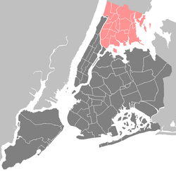
Longwood, Bronx
| Longwood | |
|---|---|
| Neighborhood of The Bronx | |

Southern Boulevard in Longwood
|
|
| Location in New York City | |
| Coordinates: 40°49′02″N 73°53′57″W / 40.817323°N 73.899303°WCoordinates: 40°49′02″N 73°53′57″W / 40.817323°N 73.899303°W | |
| Country |
|
| State |
|
| City |
|
| Borough |
|
| Area | |
| • Total | 1.27 km2 (0.489 sq mi) |
| Population (2010) | |
| • Total | 26,196 |
| • Density | 21,000/km2 (54,000/sq mi) |
| Economics | |
| • Median income | $26,300 |
| Ethnicity | |
| • Hispanic and Latino Americans | 74.6% |
| • African-American | 22.4% |
| • White | 1.5% |
| • Asian | 0.5% |
| • Others | 1.1% |
| ZIP codes | 10455, 10459 |
| Area code | 718, 347, 646 |
Longwood is an urban, mixed use, primarily residential neighborhood geographically located in the southwest Bronx, New York City. The neighborhood is part of Bronx Community Board 2. Its boundaries, starting from the north and moving clockwise are East 167th Street to the north, the Bronx River and the Bruckner Expressway to east, East 149th Street to the south, and Prospect Avenue to the west. Southern Boulevard is the primary thoroughfare through Longwood. The local subway is the 6 <6> trains, operating along Southern Blvd. ZIP codes include 10455 and 10459. The neighborhood is served by the New York City Police Department's 41st Precinct.NYCHA property in the area is patrolled by P.S.A. 7 at 737 Melrose Avenue in the Melrose section of the Bronx.
The Bronx initially began to become urban with the construction of a street-car network. Eventually, the expansion of the elevated and subterranean rapid transit lines from Manhattan rapidly accelerated development. Solid rows of 5 and 6 story, walk-up and larger elevator, apartment buildings were built to the sidewalk and dominated the landscape of Upper Manhattan, the West Bronx and in walking proximity of the elevated lines in the East Bronx. Commercial corridors quickly developed in close proximity to rapid transit stations and primary thoroughfares. Early in this construction boom, Longwood was one of the most dense and developed Bronx neighborhoods. For much of the first half of the 20th Century, the borough of the Bronx was home to a predominantly middle class, White, European descent, Jewish population. Still, there was great diversity. Immigrants of varying socioeconomic status from a number of countries, but mostly European.
Beginning in the 1950s, the older, more developed parts of the Bronx experienced a socioeconomic shift due to a number of factors. The construction of the Cross Bronx Expressway displaced thousands and physically divided communities, Co-op City in the northeast Bronx offered modern amenities and spacious apartments, and suburban communities outside New York City became more appealing with their auto-centric lifestyle. As people with financial means began to leave, poverty stricken often replaced them. White flight and abandonment only accelerated over time. By the late 1970s, many buildings in the greater South Bronx had been burnt out in an epidemic wave of arson. Scammers realized they could manipulate the system and collect insurance money after more lucrative tenants had fled. The area was severely run down as the community became increasingly disfranchised. At this time, crime reached such a level that the 41st Precinct Station House at 1086 Simpson Street became known by the police as "Fort Apache", as was later immortalized in a 1981 movie named for it.
...
Wikipedia


