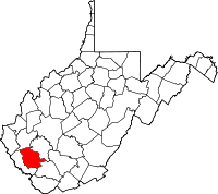
Logan County, West Virginia
| Logan County, West Virginia | |
|---|---|
 Location in the U.S. state of West Virginia |
|
 West Virginia's location in the U.S. |
|
| Founded | January 12, 1824 |
| Named for | Chief Logan |
| Seat | Logan |
| Largest city | Logan |
| Area | |
| • Total | 456 sq mi (1,181 km2) |
| • Land | 454 sq mi (1,176 km2) |
| • Water | 1.9 sq mi (5 km2), 0.4% |
| Population (est.) | |
| • (2015) | 34,707 |
| • Density | 78/sq mi (30/km²) |
| Congressional district | 3rd |
| Time zone | Eastern: UTC-5/-4 |
| Website | www |
Logan County is a county in the U.S. state of West Virginia. As of the 2010 census, the population was 36,743. Its county seat is Logan. The county was formed in 1824 from parts of Giles, Tazewell, Cabell, and Kanawha counties. It is named for Chief Logan, famous Native American chief of the Mingo tribe.
Logan County comprises the Logan, WV Micropolitan Statistical Area, which is also included in the Charleston-Huntington-Ashland, WV-OH-KY Combined Statistical Area.
In 1921 it was the location of the Battle of Blair Mountain, one of the largest armed uprisings in U.S. history. More recently, the Buffalo Creek Flood of February 26, 1972, killed 125 people when a coal slurry dam burst under the pressure of heavy rains, releasing over 100,000,000 US gallons (380,000,000 L) of waste and water in a 30-foot (9.1 m) wave onto the valley below. The communities of Lorado and Lundale were destroyed and 14 other communities heavily damaged, including Saunders, Amherstdale, Crites, and Latrobe.
...
Wikipedia
